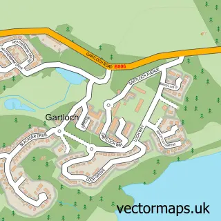
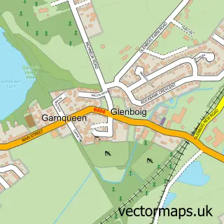
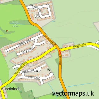
This Gartcosh street map is a detailed vector street map covering a 750m x 750m area. Select a larger area to create and download your own vector street map of Gartcosh.
The 750-metre map sample for Gartcosh covers 401 mapped buildings and approximately 18.7 km of road detail, of which 33 named roads are named. The immediate area includes 1 railway station, 2 GP surgeries within 2 miles and 5 MOT stations within 2 miles. The wider area around Gartcosh features 1 food and drink venue. To create a larger or custom map of Gartcosh, the map builder lets you define your own coverage area and download editable SVG, PDF and PNG files.
Create a larger editable map of Gartcosh
Choose any area you need and generate a high-quality vector map instantly. Perfect for print, planning, design, business and personal use.

This Gartcosh street map in Lanarkshire is available as downloadable SVG, PDF and PNG map files, or as a printed map for planning, business, display, education, local information and design work. You can also create a larger custom map area using the map selector.
What this Gartcosh map sample shows
Gartcosh lies within North Lanarkshire parish, part of Gartcosh, Glenboig And Moodiesburn ward in the North Lanarkshire local authority area. The postcode geography for this area includes the G postcode area, the G69 postcode district and the G69 8 postcode sector. Residents fall under the Lanarkshire for NHS services.
Local features near Gartcosh
Within 2 milesAmenities and services in and around Gartcosh.
Administrative and postcode information for Gartcosh
Gartcosh lies within North Lanarkshire parish, part of Gartcosh, Glenboig And Moodiesburn ward in the North Lanarkshire local authority area. The postcode geography for this area includes the G postcode area, the G69 postcode district and the G69 8 postcode sector. Residents fall under the Lanarkshire for NHS services.
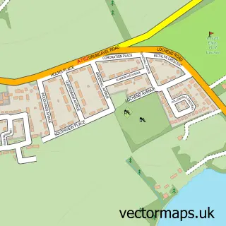
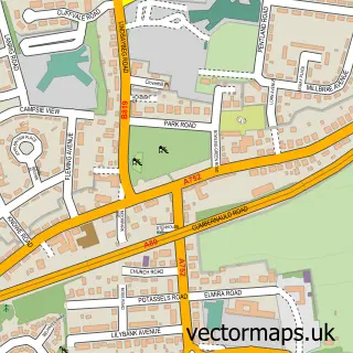
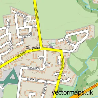
Nearby street map samples around Gartcosh

More street maps in Lanarkshire
750 metre map area coverage
Boundary, postcode and point of interest information for the 750m x 750m rectangle centred on this sample map.
Boundaries containing map centre
Constituency: Coatbridge and Bellshill Burgh Const
District: North Lanarkshire
Icb: Lanarkshire
Postcode District: G69
Postcode Sector: G69 8
Ward: Gartcosh, Glenboig and Moodiesburn Ward
Nearby boundaries intersecting sample
No additional intersecting boundaries found.
Postcode coverage
POI category counts
Architecture: 2
Chinese Restaurant: 2
Professional Services: 2
Active Life: 1
Architectural Designer: 1
Atms: 1
Beauty Salon: 1
Church Cathedral: 1
Convenience Store: 1
Doctor: 1
Sample points of interest
- Gartcosh Bowling Club
- Sixteen Times Architecture
- Scotdraw Architectural Services
- Scotdraw Architectural Services
- Shop Local Gartcosh (Link DC), Gartcosh
- Gillian Woods Hair
- Asia
- Chin Chin Restaurant
- Gartcosh Parish Church
- USAVE
- Medicspot Clinic Gartcosh
- Weston Transport
Create a larger editable map of Gartcosh
This sample shows only a 750 metre area. To create a larger map of Gartcosh, use our map builder to choose your own coverage area, add titles and download editable SVG, PDF and PNG files.
Create a custom map of Gartcosh