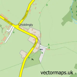
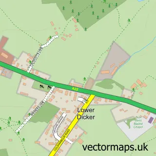
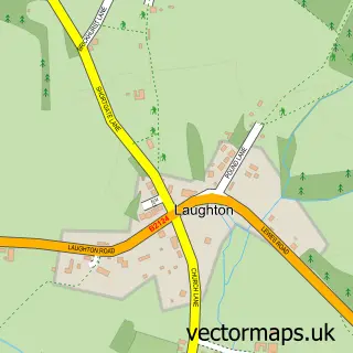
This Golden Cross street map is a detailed vector street map covering a 750m x 750m area. Select a larger area to create and download your own vector street map of Golden Cross.
The 750-metre map sample for Golden Cross covers 107 mapped buildings and approximately 7.3 km of road detail, of which 4 named roads are named. The immediate area includes 1 pub and 1 MOT station within 2 miles. The wider area around Golden Cross features 1 tourism point of interest, 2 food and drink venues and 4 campsites within 2 miles. To create a larger or custom map of Golden Cross, the map builder lets you define your own coverage area and download editable SVG, PDF and PNG files.
Create a larger editable map of Golden Cross
Choose any area you need and generate a high-quality vector map instantly. Perfect for print, planning, design, business and personal use.

This Golden Cross street map in East Sussex is available as downloadable SVG, PDF and PNG map files, or as a printed map for planning, business, display, education, local information and design work. You can also create a larger custom map area using the map selector.
What this Golden Cross map sample shows
Golden Cross lies within Chiddingly Cp parish, part of Chiddingly, East Hoathly & Waldron ward in the Wealden District local authority area. The postcode geography for this area includes the BN postcode area, the BN27 postcode district and the BN27 4 postcode sector. Residents fall under the Nhs Sussex Integrated Care Board for NHS services.
Local features near Golden Cross
Within 2 milesAmenities and services in and around Golden Cross.
Administrative and postcode information for Golden Cross
Golden Cross lies within Chiddingly Cp parish, part of Chiddingly, East Hoathly & Waldron ward in the Wealden District local authority area. The postcode geography for this area includes the BN postcode area, the BN27 postcode district and the BN27 4 postcode sector. Residents fall under the Nhs Sussex Integrated Care Board for NHS services.
Nearby street map samples around Golden Cross

More street maps in East Sussex
750 metre map area coverage
Boundary, postcode and point of interest information for the 750m x 750m rectangle centred on this sample map.
Boundaries containing map centre
Constituency: Sussex Weald Co Const
County: East Sussex County
District: Wealden District
Icb: NHS Surrey and Sussex ICB
Parish: Chiddingly CP
Police Force: sussex
Postcode District: BN27
Postcode Sector: BN27 4
Ward: Chiddingly, East Hoathly & Waldron Ward
Nearby boundaries intersecting sample
Postcode District: BN8
Postcode Sector: BN27 3, BN8 6
Postcode coverage
POI category counts
Professional Services: 3
Supermarket: 2
Acupuncture: 1
Atms: 1
Campground: 1
Church Cathedral: 1
Coffee Shop: 1
Convenience Store: 1
Cottage: 1
Gas Station: 1
Sample points of interest
- J Gordon Acupuncture
- MFG - Golden Cross (MRH)
- Oakfield farm camping
- Golden Cross Chapel
- Costa Express
- Londis Golden Cross
- Golden Cross Holiday Park
- BP
- Jenny Bowman Electrolysis
- Findon Legal Consultants
- Osborn Leisure Lodges
- InPost
Create a larger editable map of Golden Cross
This sample shows only a 750 metre area. To create a larger map of Golden Cross, use our map builder to choose your own coverage area, add titles and download editable SVG, PDF and PNG files.
Create a custom map of Golden Cross