Vector Maps logo
Home Why it works Popular maps Districts Samples Customizer Create Your Map
VectorMaps.uk
Home Popular maps Districts Samples Customizer Create Your Map Privacy Disclaimer
Home / UK Maps / Nottinghamshire / Gotham Map

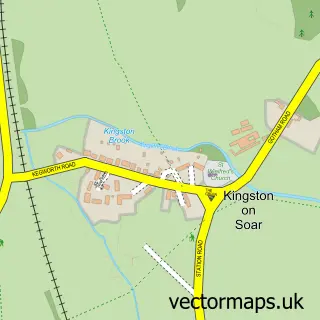
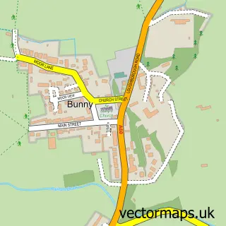
This Gotham street map is a detailed vector street map covering a 750m x 750m area. Select a larger area to create and download your own vector street map of Gotham.

Gotham is a village in Nottinghamshire, in the East Midlands of England. The settlement falls within the Rushcliffe parliamentary constituency. It is served by the NG11 postcode district, with NG11 0 as the local postcode sector.

The 750-metre map sample for Gotham covers 356 mapped buildings and approximately 16.2 km of road detail, of which 30 named roads are named. The immediate area includes 4 pubs and 1 MOT station. The wider area around Gotham features 4 food and drink venues. To create a larger or custom map of Gotham, the map builder lets you define your own coverage area and download editable SVG, PDF and PNG files.

356Buildings
16.21 kmRoads
30Named roads
1,154Residents within 2 miles
Create your own

Create a larger editable map of Gotham

Choose any area you need and generate a high-quality vector map instantly. Perfect for print, planning, design, business and personal use.

Choose any location
Editable SVG files
Any size up to A0
PDF, PNG & more
Instant download
High quality guaranteed
Create My Custom Map
Secure, private & no credit card required
Gotham Vector Street Map
750m Sample
Gotham vector street map sample showing roads, buildings and local features in a 750 metre preview area
Buy Gotham Map Print from £12.95 Buy Gotham Digital Map from £6

This Gotham street map in Nottinghamshire is available as downloadable SVG, PDF and PNG map files, or as a printed map for planning, business, display, education, local information and design work. You can also create a larger custom map area using the map selector.

What this Gotham map sample shows

Gotham lies within Gotham Cp parish, part of Gotham ward in the Rushcliffe District (B) local authority area. The postcode geography for this area includes the NG postcode area, the NG11 postcode district and the NG11 0 postcode sector. Residents fall under the Nhs Nottingham And Nottinghamshire Integrated Care Board for NHS services.

Local features near Gotham

Within 2 miles

Amenities and services in and around Gotham.

1 MOT stations 1 within 2 miles
4 Food & drink
4 Pubs
1 Healthcare POIs
1 Vehicle services

Counts are approximate and based on publicly available data.

Administrative and postcode information for Gotham

Gotham lies within Gotham Cp parish, part of Gotham ward in the Rushcliffe District (B) local authority area. The postcode geography for this area includes the NG postcode area, the NG11 postcode district and the NG11 0 postcode sector. Residents fall under the Nhs Nottingham And Nottinghamshire Integrated Care Board for NHS services.

Parish Gotham CP
Ward Gotham
District / local authority Rushcliffe District (B)
County Nottinghamshire
Historic county Nottinghamshire
Postcode district NG11
Postcode sector NG11 0
Parliamentary constituency Rushcliffe
Region East Midlands
Country England

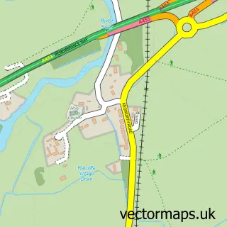
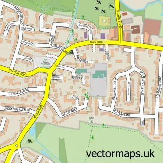
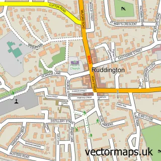
Nearby street map samples around Gotham

Street map sample of Long Eaton, Derbyshire Long Eaton Town - Derbyshire - 3.6 miles Street map sample of Nottingham, Nottinghamshire Nottingham City - Nottinghamshire - 6.4 miles Street map sample of Barton-in-Fabis, Nottinghamshire Barton-in-Fabis Village - Nottinghamshire - 1.8 miles Street map sample of Thrumpton, Nottinghamshire Thrumpton Village - Nottinghamshire - 1.9 miles Street map sample of West Leake, Nottinghamshire West Leake Village - Nottinghamshire - 2.4 miles Street map sample of Ratcliffe-on-Soar, Nottinghamshire Ratcliffe-on-Soar Village - Nottinghamshire - 2.7 miles Street map sample of Kingston on Soar, Nottinghamshire Kingston on Soar Village - Nottinghamshire - 2.7 miles Street map sample of East Leake, Nottinghamshire East Leake Village - Nottinghamshire - 2.8 miles Street map sample of Ruddington, Nottinghamshire Ruddington Village - Nottinghamshire - 2.8 miles Street map sample of Bunny, Nottinghamshire Bunny Village - Nottinghamshire - 2.9 miles

More street maps in Nottinghamshire

Street map sample of Barton-in-Fabis, Nottinghamshire Barton-in-Fabis Village - 1.8 miles Street map sample of Thrumpton, Nottinghamshire Thrumpton Village - 1.9 miles Street map sample of West Leake, Nottinghamshire West Leake Village - 2.4 miles Street map sample of Ratcliffe-on-Soar, Nottinghamshire Ratcliffe-on-Soar Village - 2.7 miles Street map sample of Kingston on Soar, Nottinghamshire Kingston on Soar Village - 2.7 miles

750 metre map area coverage

Boundary, postcode and point of interest information for the 750m x 750m rectangle centred on this sample map.

Boundaries containing map centre

Constituency: Rushcliffe Co Const

County: Nottinghamshire County

District: Rushcliffe District (B)

Icb: NHS Nottingham and Nottinghamshire ICB

Parish: Gotham CP

Police Force: nottinghamshire

Postcode District: NG11

Postcode Sector: NG11 0

Ward: Gotham Ward

Nearby boundaries intersecting sample

No additional intersecting boundaries found.

Postcode coverage

NG11 NG11 0

POI category counts

Building Supply Store: 4

Pub: 4

Convenience Store: 2

Language School: 2

Post Office: 2

Scout Hall: 2

Auto Upholstery: 1

Automotive Repair: 1

Bar: 1

Beauty Salon: 1

Sample points of interest

  • Anray Choice Furnishings Auto Upholstery
  • Gotham Service Station Automotive Repair
  • Gotham Memorial Hall Bar
  • Equilibrium Hair & Beauty Beauty Salon
  • D K Electrix Building Supply Store
  • Happy Hearth Building Supply Store
  • IMM Design & Build Building Supply Store
  • Jp International Consultants Building Supply Store
  • St. Annes Textiles Ltd. Business To Business
  • St Lawrence Church Church Cathedral
  • Rushcliffe Fencing Contractor
  • SPAR Convenience Store

Create a larger editable map of Gotham

This sample shows only a 750 metre area. To create a larger map of Gotham, use our map builder to choose your own coverage area, add titles and download editable SVG, PDF and PNG files.

Create a custom map of Gotham

Phone 01751 473136 | Copyright Vectormaps.uk 2026

Samples Customizer Privacy Disclaimer
Gotham Vector Street Map
Gotham enlarged street map sample showing a 750 metre preview area