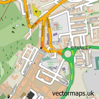
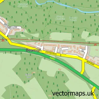
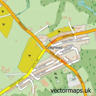
This Grange Villa street map is a detailed vector street map covering a 750m x 750m area. Select a larger area to create and download your own vector street map of Grange Villa.
The 750-metre map sample for Grange Villa covers 70 mapped buildings and approximately 9.1 km of road detail, of which 8 named roads are named. The immediate area includes 3 GP surgeries within 2 miles and 4 MOT stations within 2 miles. The wider area around Grange Villa features 1 tourism point of interest. To create a larger or custom map of Grange Villa, the map builder lets you define your own coverage area and download editable SVG, PDF and PNG files.
Create a larger editable map of Grange Villa
Choose any area you need and generate a high-quality vector map instantly. Perfect for print, planning, design, business and personal use.

This Grange Villa street map in Durham is available as downloadable SVG, PDF and PNG map files, or as a printed map for planning, business, display, education, local information and design work. You can also create a larger custom map area using the map selector.
What this Grange Villa map sample shows
Grange Villa lies within Pelton Cp parish, part of Pelton ward in the County Durham local authority area. The postcode geography for this area includes the DH postcode area, the DH2 postcode district and the DH2 3 postcode sector. Residents fall under the Nhs North East And North Cumbria Integrated Care Board for NHS services.
Local features near Grange Villa
Within 2 milesAmenities and services in and around Grange Villa.
Administrative and postcode information for Grange Villa
The local authority covering Grange Villa is County Durham, within the county of Durham. The settlement lies within Pelton ward and Pelton Cp civil parish. The DH2 postcode district and DH2 3 postcode sector serve the immediate area. NHS provision in the area is delivered through County Durham And Darlington Nhs Foundation Trust.
Nearby street map samples around Grange Villa

More street maps in Durham
750 metre map area coverage
Boundary, postcode and point of interest information for the 750m x 750m rectangle centred on this sample map.
Boundaries containing map centre
Constituency: North Durham Co Const
District: County Durham
Icb: NHS North East and North Cumbria ICB
Parish: Pelton CP
Police Force: durham
Postcode District: DH2
Postcode Sector: DH2 3
Nearby boundaries intersecting sample
Parish: Edmondsley CP
Postcode Sector: DH2 2
Postcode coverage
POI category counts
Car Dealer: 2
Atms: 1
Automotive Repair: 1
Community Center: 1
Contractor: 1
Convenience Store: 1
Fish And Chips Restaurant: 1
Grocery Store: 1
Health Consultant: 1
Key And Locksmith: 1
Sample points of interest
- Somals News Food & Wine, Grange Villa
- WNDS Cars
- Grange Villa Cars
- Wheelchair Vehicles Northeast Ltd
- Grange Villa Community Enterprise
- Cannon Home Improvements Ltd
- Premier
- Front Street Fish and Chips
- Premier - Somal News Food and Wine
- Joanna Coulthard - Health & wellbeing
- Popalockuk
- Dream Big Role Play Centre
Create a larger editable map of Grange Villa
This sample shows only a 750 metre area. To create a larger map of Grange Villa, use our map builder to choose your own coverage area, add titles and download editable SVG, PDF and PNG files.
Create a custom map of Grange Villa