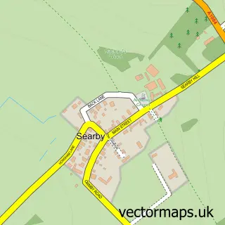
This Grasby street map is a detailed vector street map covering a 750m x 750m area. Select a larger area to create and download your own vector street map of Grasby.
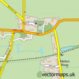
The 750-metre map sample for Grasby covers 222 mapped buildings and approximately 11.0 km of road detail, of which 14 named roads are named. The immediate area includes 1 school and 1 pub. The wider area around Grasby features 1 food and drink venue. To create a larger or custom map of Grasby, the map builder lets you define your own coverage area and download editable SVG, PDF and PNG files.
Create a larger editable map of Grasby
Choose any area you need and generate a high-quality vector map instantly. Perfect for print, planning, design, business and personal use.

This Grasby street map in Lincolnshire is available as downloadable SVG, PDF and PNG map files, or as a printed map for planning, business, display, education, local information and design work. You can also create a larger custom map area using the map selector.
What this Grasby map sample shows
Grasby lies within Grasby Cp parish, part of Kelsey Wold ward in the West Lindsey District local authority area. The postcode geography for this area includes the DN postcode area, the DN38 postcode district and the DN38 6 postcode sector. Residents fall under the Nhs Lincolnshire Integrated Care Board for NHS services.
Local features near Grasby
Within 2 milesAmenities and services in and around Grasby.
Administrative and postcode information for Grasby
Grasby lies within Grasby Cp parish, part of Kelsey Wold ward in the West Lindsey District local authority area. The postcode geography for this area includes the DN postcode area, the DN38 postcode district and the DN38 6 postcode sector. Residents fall under the Nhs Lincolnshire Integrated Care Board for NHS services.
Nearby street map samples around Grasby

More street maps in Lincolnshire
750 metre map area coverage
Boundary, postcode and point of interest information for the 750m x 750m rectangle centred on this sample map.
Boundaries containing map centre
Constituency: Gainsborough Co Const
County: Lincolnshire County
District: West Lindsey District
Icb: NHS Lincolnshire ICB
Parish: Grasby CP
Police Force: lincolnshire
Postcode District: DN38
Postcode Sector: DN38 6
Ward: Kelsey Wold Ward
Nearby boundaries intersecting sample
Parish: Searby cum Owmby CP
Postcode coverage
POI category counts
Anglican Church: 1
Arts And Crafts: 1
Auto Company: 1
Bed And Breakfast: 1
Elementary School: 1
Hvac Supplier: 1
Pub: 1
Scout Hall: 1
Sample points of interest
- All Saints
- Lowery Workstands
- MGCC Lincolnshire Wolds Natter
- Little Hen Bed & Breakfast
- Grasby Allsaints C of E Primary School
- A Shaw Heating
- The Cross Keys Inn
- Grasby
Create a larger editable map of Grasby
This sample shows only a 750 metre area. To create a larger map of Grasby, use our map builder to choose your own coverage area, add titles and download editable SVG, PDF and PNG files.
Create a custom map of Grasby