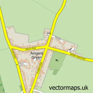
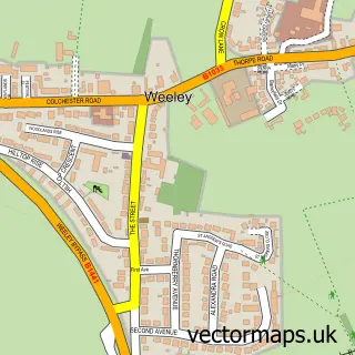
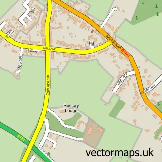
This Great Bentley street map is a detailed vector street map covering a 750m x 750m area. Select a larger area to create and download your own vector street map of Great Bentley.
The 750-metre map sample for Great Bentley covers 426 mapped buildings and approximately 15.9 km of road detail, of which 23 named roads are named. The immediate area includes 1 GP surgery, 1 pub and 5 MOT stations within 2 miles. The wider area around Great Bentley features 2 food and drink venues. To create a larger or custom map of Great Bentley, the map builder lets you define your own coverage area and download editable SVG, PDF and PNG files.
Create a larger editable map of Great Bentley
Choose any area you need and generate a high-quality vector map instantly. Perfect for print, planning, design, business and personal use.

This Great Bentley street map in Essex is available as downloadable SVG, PDF and PNG map files, or as a printed map for planning, business, display, education, local information and design work. You can also create a larger custom map area using the map selector.
What this Great Bentley map sample shows
Great Bentley lies within Great Bentley Cp parish, part of The Bentleys & Frating ward in the Tendring District local authority area. The postcode geography for this area includes the CO postcode area, the CO7 postcode district and the CO7 8 postcode sector. Residents fall under the Nhs Suffolk And North East Essex Integrated Care Board for NHS services.
Local features near Great Bentley
Within 2 milesAmenities and services in and around Great Bentley.
Administrative and postcode information for Great Bentley
Great Bentley lies within Great Bentley Cp parish, part of The Bentleys & Frating ward in the Tendring District local authority area. The postcode geography for this area includes the CO postcode area, the CO7 postcode district and the CO7 8 postcode sector. Residents fall under the Nhs Suffolk And North East Essex Integrated Care Board for NHS services.
Nearby street map samples around Great Bentley

More street maps in Essex
750 metre map area coverage
Boundary, postcode and point of interest information for the 750m x 750m rectangle centred on this sample map.
Boundaries containing map centre
Constituency: Clacton Co Const
County: Essex County
District: Tendring District
Icb: NHS Essex ICB
Parish: Great Bentley CP
Police Force: essex
Postcode District: CO7
Postcode Sector: CO7 8
Ward: The Bentleys & Frating Ward
Nearby boundaries intersecting sample
No additional intersecting boundaries found.
Postcode coverage
POI category counts
Church Cathedral: 4
Sports Club And League: 3
Bed And Breakfast: 2
Industrial Equipment: 2
Professional Services: 2
Scout Hall: 2
Alternative Medicine: 1
Anglican Church: 1
Ceiling And Roofing Repair And Service: 1
Doctor: 1
Sample points of interest
- Gp Pharmacies
- Great Bentley: St Mary the Virgin
- Scarlett Rose Sings
- The Jasmine Room
- Eastern Counties Home Improvements Ltd.
- Great Bentley Methodist Church
- Penial Church of God
- St Mary's Church
- St Marys Great Bentley
- The Hollies Doctors Surgery
- Plan Money
- Eastern Counties Home Improvements
Create a larger editable map of Great Bentley
This sample shows only a 750 metre area. To create a larger map of Great Bentley, use our map builder to choose your own coverage area, add titles and download editable SVG, PDF and PNG files.
Create a custom map of Great Bentley