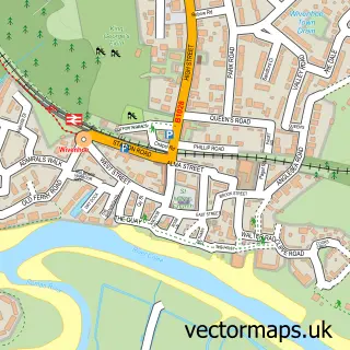
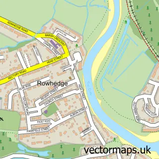
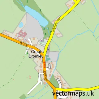
This Alresford street map is a detailed vector street map covering a 750m x 750m area. Select a larger area to create and download your own vector street map of Alresford.
The 750-metre map sample for Alresford covers 407 mapped buildings and approximately 10.4 km of road detail, of which 19 named roads are named. The immediate area includes 1 school, 1 GP surgery within 2 miles and 2 MOT stations within 2 miles. The wider area around Alresford features 1 tourism point of interest. To create a larger or custom map of Alresford, the map builder lets you define your own coverage area and download editable SVG, PDF and PNG files.
Create a larger editable map of Alresford
Choose any area you need and generate a high-quality vector map instantly. Perfect for print, planning, design, business and personal use.

This Alresford street map in Essex is available as downloadable SVG, PDF and PNG map files, or as a printed map for planning, business, display, education, local information and design work. You can also create a larger custom map area using the map selector.
What this Alresford map sample shows
Alresford lies within Alresford Cp parish, part of Alresford & Elmstead ward in the Tendring District local authority area. The postcode geography for this area includes the CO postcode area, the CO7 postcode district and the CO7 8 postcode sector. Residents fall under the Nhs Suffolk And North East Essex Integrated Care Board for NHS services.
Local features near Alresford
Within 2 milesAmenities and services in and around Alresford.
Administrative and postcode information for Alresford
Alresford lies within Alresford Cp parish, part of Alresford & Elmstead ward in the Tendring District local authority area. The postcode geography for this area includes the CO postcode area, the CO7 postcode district and the CO7 8 postcode sector. Residents fall under the Nhs Suffolk And North East Essex Integrated Care Board for NHS services.
Nearby street map samples around Alresford

More street maps in Essex
750 metre map area coverage
Boundary, postcode and point of interest information for the 750m x 750m rectangle centred on this sample map.
Boundaries containing map centre
Constituency: Harwich and North Essex Co Const
County: Essex County
District: Tendring District
Icb: NHS Essex ICB
Parish: Alresford CP
Police Force: essex
Postcode District: CO7
Postcode Sector: CO7 8
Ward: Alresford & Elmstead Ward
Nearby boundaries intersecting sample
No additional intersecting boundaries found.
Postcode coverage
POI category counts
Anglican Church: 2
Beauty Salon: 2
Building Supply Store: 2
Elementary School: 2
Appliance Manufacturer: 1
Carpenter: 1
Carpet Store: 1
Community Center: 1
Corporate Entertainment Services: 1
Currency Exchange: 1
Sample points of interest
- St Andrew's, Alresford
- Tenpenny Village Churches
- Ernie Osborne Motor Trade
- CM Hair & Skin Solutions
- Sage Hair Studio Ltd
- Dukelow Construction Ltd
- Roof Right
- Sj Cashman
- Main Line Carpets
- Alresford Village Hall
- The Talent
- Post Office Travel Money
Create a larger editable map of Alresford
This sample shows only a 750 metre area. To create a larger map of Alresford, use our map builder to choose your own coverage area, add titles and download editable SVG, PDF and PNG files.
Create a custom map of Alresford