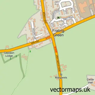
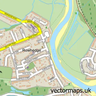
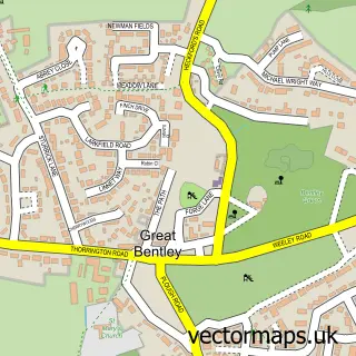
This Elmstead Market street map is a detailed vector street map covering a 750m x 750m area. Select a larger area to create and download your own vector street map of Elmstead Market.
The 750-metre map sample for Elmstead Market covers 529 mapped buildings and approximately 12.5 km of road detail, of which 22 named roads are named. The immediate area includes 1 school and 1 MOT station within 2 miles. The wider area around Elmstead Market features 2 food and drink venues. To create a larger or custom map of Elmstead Market, the map builder lets you define your own coverage area and download editable SVG, PDF and PNG files.
Create a larger editable map of Elmstead Market
Choose any area you need and generate a high-quality vector map instantly. Perfect for print, planning, design, business and personal use.

This Elmstead Market street map in Essex is available as downloadable SVG, PDF and PNG map files, or as a printed map for planning, business, display, education, local information and design work. You can also create a larger custom map area using the map selector.
What this Elmstead Market map sample shows
Elmstead Market lies within Elmstead Cp parish, part of Alresford & Elmstead ward in the Tendring District local authority area. The postcode geography for this area includes the CO postcode area, the CO7 postcode district and the CO7 7 postcode sector. Residents fall under the Nhs Suffolk And North East Essex Integrated Care Board for NHS services.
Local features near Elmstead Market
Within 2 milesAmenities and services in and around Elmstead Market.
Administrative and postcode information for Elmstead Market
The local authority covering Elmstead Market is Tendring District, within the county of Essex. The settlement lies within Alresford & Elmstead ward and Elmstead Cp civil parish. The CO7 postcode district and CO7 7 postcode sector serve the immediate area. NHS provision in the area is delivered through East Suffolk And North Essex Nhs Foundation Trust.
Nearby street map samples around Elmstead Market

More street maps in Essex
750 metre map area coverage
Boundary, postcode and point of interest information for the 750m x 750m rectangle centred on this sample map.
Boundaries containing map centre
Constituency: Harwich and North Essex Co Const
County: Essex County
District: Tendring District
Icb: NHS Essex ICB
Parish: Elmstead CP
Police Force: essex
Postcode District: CO7
Postcode Sector: CO7 7
Ward: Alresford & Elmstead Ward
Nearby boundaries intersecting sample
No additional intersecting boundaries found.
Postcode coverage
POI category counts
Beauty Salon: 3
Convenience Store: 3
Gas Station: 3
Aquatic Pet Store: 2
Assisted Living Facility: 2
Cafe: 2
Church Cathedral: 2
Rental Kiosks: 2
Shipping Center: 2
Supermarket: 2
Sample points of interest
- Goody Chartered Accountants and Tax Advisors
- Bastin Day Westley
- Betta Aquatics
- Reef Exotics
- Elm Park Cottage
- Saresta & Serenade
- MFG - Elmstead (MRH), Elmstead Market
- Ellie Rose Beauty
- Flair Hair
- Soft Tone
- The Elmstead Beauty Room
- Sparks Electrical
Create a larger editable map of Elmstead Market
This sample shows only a 750 metre area. To create a larger map of Elmstead Market, use our map builder to choose your own coverage area, add titles and download editable SVG, PDF and PNG files.
Create a custom map of Elmstead Market