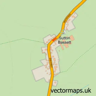
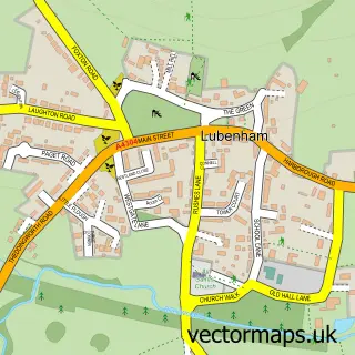
This Great Bowden street map is a detailed vector street map covering a 750m x 750m area. Select a larger area to create and download your own vector street map of Great Bowden.
The 750-metre map sample for Great Bowden covers 272 mapped buildings and approximately 25.5 km of road detail, of which 15 named roads are named. The immediate area includes 1 school, 1 GP surgery within 2 miles, 2 pubs and 9 MOT stations within 2 miles. The wider area around Great Bowden features 3 food and drink venues. To create a larger or custom map of Great Bowden, the map builder lets you define your own coverage area and download editable SVG, PDF and PNG files.
Create a larger editable map of Great Bowden
Choose any area you need and generate a high-quality vector map instantly. Perfect for print, planning, design, business and personal use.

This Great Bowden street map in Leicestershire is available as downloadable SVG, PDF and PNG map files, or as a printed map for planning, business, display, education, local information and design work. You can also create a larger custom map area using the map selector.
What this Great Bowden map sample shows
Great Bowden lies within Great Bowden Cp parish, part of Market Harborough-Great Bowden & Arden ward in the Harborough District local authority area. The postcode geography for this area includes the LE postcode area, the LE16 postcode district and the LE16 7 postcode sector. Residents fall under the Nhs Leicester, Leicestershire And Rutland Integrated Care Board for NHS services.
Local features near Great Bowden
Within 2 milesAmenities and services in and around Great Bowden.
Administrative and postcode information for Great Bowden
Great Bowden lies within Great Bowden Cp parish, part of Market Harborough-Great Bowden & Arden ward in the Harborough District local authority area. The postcode geography for this area includes the LE postcode area, the LE16 postcode district and the LE16 7 postcode sector. Residents fall under the Nhs Leicester, Leicestershire And Rutland Integrated Care Board for NHS services.
Nearby street map samples around Great Bowden

More street maps in Leicestershire
750 metre map area coverage
Boundary, postcode and point of interest information for the 750m x 750m rectangle centred on this sample map.
Boundaries containing map centre
Constituency: Harborough, Oadby and Wigston Co Const
County: Leicestershire County
District: Harborough District
Icb: NHS Leicester Leicestershire and Rutland ICB
Parish: Great Bowden CP
Police Force: leicestershire
Postcode District: LE16
Postcode Sector: LE16 7
Ward: Market Harborough-Great Bowden & Arden Ward
Nearby boundaries intersecting sample
No additional intersecting boundaries found.
Postcode coverage
POI category counts
Delicatessen: 2
Post Office: 2
Pub: 2
Acupuncture: 1
Advertising Agency: 1
Anglican Church: 1
Architectural Designer: 1
Atms: 1
Beauty And Spa: 1
Bed And Breakfast: 1
Sample points of interest
- The Acupuncture Clinic
- Absolute Internet Marketing
- St Peter and St Paul, Great Bowden
- JED Design (Architectural Services) Ltd
- ATM (Post Office)
- Bowden Therapies
- Langton Brook Farm
- Welton’s Cafe, Shop & Post Office
- Ben Gray Gardens
- Bowden Stores
- Xena Automotive
- St Peter and St Paul Church
Create a larger editable map of Great Bowden
This sample shows only a 750 metre area. To create a larger map of Great Bowden, use our map builder to choose your own coverage area, add titles and download editable SVG, PDF and PNG files.
Create a custom map of Great Bowden