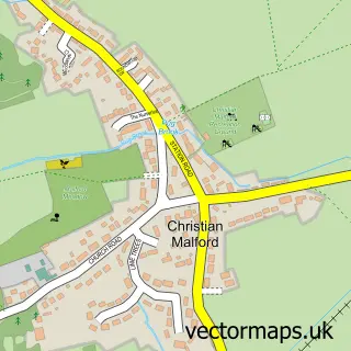
This Great Somerford street map is a detailed vector street map covering a 750m x 750m area. Select a larger area to create and download your own vector street map of Great Somerford.
The 750-metre map sample for Great Somerford covers 237 mapped buildings and approximately 8.7 km of road detail, of which 10 named roads are named. The immediate area includes 1 school and 1 pub. The wider area around Great Somerford features 1 tourism point of interest and 1 food and drink venue. To create a larger or custom map of Great Somerford, the map builder lets you define your own coverage area and download editable SVG, PDF and PNG files.
Create a larger editable map of Great Somerford
Choose any area you need and generate a high-quality vector map instantly. Perfect for print, planning, design, business and personal use.

This Great Somerford street map in Wiltshire is available as downloadable SVG, PDF and PNG map files, or as a printed map for planning, business, display, education, local information and design work. You can also create a larger custom map area using the map selector.
What this Great Somerford map sample shows
Great Somerford lies within Great Somerford Cp parish, part of Brinkworth ward in the Wiltshire local authority area. The postcode geography for this area includes the SN postcode area, the SN15 postcode district and the SN15 5 postcode sector. Residents fall under the Nhs Bath And North East Somerset, Swindon And Wiltshire Integrated Care Board for NHS services.
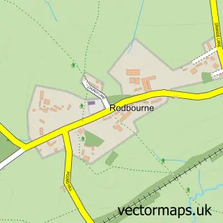
Local features near Great Somerford
Within 2 milesAmenities and services in and around Great Somerford.
Administrative and postcode information for Great Somerford
The local authority covering Great Somerford is Wiltshire, within the county of Wiltshire. The settlement lies within Brinkworth ward and Great Somerford Cp civil parish. The SN15 postcode district and SN15 5 postcode sector serve the immediate area. NHS provision in the area is delivered through Great Western Hospitals Nhs Foundation Trust.
Nearby street map samples around Great Somerford

More street maps in Wiltshire
750 metre map area coverage
Boundary, postcode and point of interest information for the 750m x 750m rectangle centred on this sample map.
Boundaries containing map centre
Constituency: South Cotswolds Co Const
District: Wiltshire
Icb: NHS Bath and North East Somerset Swindon and Wiltshire ICB
Parish: Great Somerford CP
Police Force: wiltshire
Postcode District: SN15
Postcode Sector: SN15 5
Nearby boundaries intersecting sample
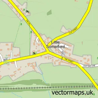
Parish: Little Somerford CP
Postcode coverage
POI category counts
Automotive Repair: 2
Church Cathedral: 2
Elementary School: 2
Post Office: 2
Anglican Church: 1
Auto Restoration Services: 1
Bookkeeper: 1
Broadcasting Media Production: 1
Building Supply Store: 1
Campground: 1
Sample points of interest
- St Peter & St Paul, Great Somerford
- Grandstand Coachworks
- A1 Vauxhall
- Somerford Mini
- Lava Sky Accounting | Expert Bookkeeping & Accounting Services
- Daniel C Films
- Double Glazing Repairs
- Great Somerford Caravan Site
- Cheap Car Rental
- Great Somerford church uk
- St Peter and St Paul's Church
- Londis
Create a larger editable map of Great Somerford
This sample shows only a 750 metre area. To create a larger map of Great Somerford, use our map builder to choose your own coverage area, add titles and download editable SVG, PDF and PNG files.
Create a custom map of Great Somerford