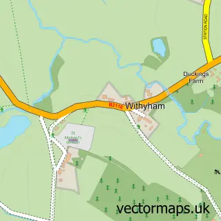
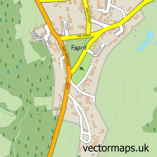
This Groombridge street map is a detailed vector street map covering a 750m x 750m area. Select a larger area to create and download your own vector street map of Groombridge.
The 750-metre map sample for Groombridge covers 285 mapped buildings and approximately 9.9 km of road detail, of which 16 named roads are named. The immediate area includes 1 railway station, 1 GP surgery, 2 pubs and 1 MOT station. The wider area around Groombridge features 3 food and drink venues and 1 campsite within 2 miles. To create a larger or custom map of Groombridge, the map builder lets you define your own coverage area and download editable SVG, PDF and PNG files.
Create a larger editable map of Groombridge
Choose any area you need and generate a high-quality vector map instantly. Perfect for print, planning, design, business and personal use.

This Groombridge street map in East Sussex is available as downloadable SVG, PDF and PNG map files, or as a printed map for planning, business, display, education, local information and design work. You can also create a larger custom map area using the map selector.
What this Groombridge map sample shows
Groombridge lies within Withyham Cp parish, part of Withyham ward in the Wealden District local authority area. The postcode geography for this area includes the TN postcode area, the TN3 postcode district and the TN3 9 postcode sector. Residents fall under the Nhs Sussex Integrated Care Board for NHS services.
Local features near Groombridge
Within 2 milesAmenities and services in and around Groombridge.
Administrative and postcode information for Groombridge
The local authority covering Groombridge is Wealden District, within the county of East Sussex. The settlement lies within Withyham ward and Withyham Cp civil parish. The TN3 postcode district and TN3 9 postcode sector serve the immediate area. NHS provision in the area is delivered through Maidstone And Tunbridge Wells Nhs Trust.
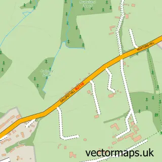
Nearby street map samples around Groombridge

More street maps in East Sussex
750 metre map area coverage
Boundary, postcode and point of interest information for the 750m x 750m rectangle centred on this sample map.
Boundaries containing map centre
Constituency: Sussex Weald Co Const
County: East Sussex County
District: Wealden District
Icb: NHS Surrey and Sussex ICB
Parish: Withyham CP
Police Force: sussex
Postcode District: TN3
Postcode Sector: TN3 9
Ward: Withyham Ward
Nearby boundaries intersecting sample
Constituency: Tunbridge Wells Co Const
County: Kent County
District: Tunbridge Wells District (B)
Icb: NHS Kent and Medway ICB
Parish: Speldhurst CP
Police Force: kent
Ward: Rusthall & Speldhurst Ward
Postcode coverage
POI category counts
Convenience Store: 2
Korean Grocery Store: 2
Pub: 2
Scout Hall: 2
Advertising Agency: 1
Alternative Medicine: 1
Anglican Church: 1
Automotive Repair: 1
Beauty And Spa: 1
Car Dealer: 1
Sample points of interest
- Aquamarine
- Groombridge Osteopathy
- St Thomas The Apostle Groombridge
- Groombridge Motoring Centre
- Electra London
- VFM Autosales Ltd Groombridge
- Eastridge Carpentry
- St Thomas's Church
- Costa Express
- Groombridge Village Hall
- Premier
- Spar
Create a larger editable map of Groombridge
This sample shows only a 750 metre area. To create a larger map of Groombridge, use our map builder to choose your own coverage area, add titles and download editable SVG, PDF and PNG files.
Create a custom map of Groombridge