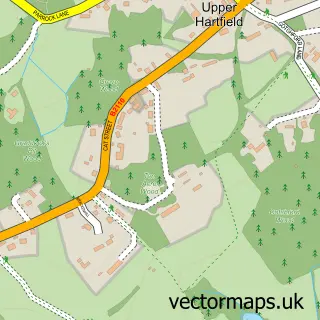
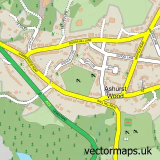
This Hartfield street map is a detailed vector street map covering a 750m x 750m area. Select a larger area to create and download your own vector street map of Hartfield.
The 750-metre map sample for Hartfield covers 143 mapped buildings and approximately 9.1 km of road detail, of which 9 named roads are named. The immediate area includes 1 school, 1 pub and 1 MOT station within 2 miles. The wider area around Hartfield features 1 tourism point of interest, 3 food and drink venues and 1 campsite within 2 miles. To create a larger or custom map of Hartfield, the map builder lets you define your own coverage area and download editable SVG, PDF and PNG files.
Create a larger editable map of Hartfield
Choose any area you need and generate a high-quality vector map instantly. Perfect for print, planning, design, business and personal use.

This Hartfield street map in East Sussex is available as downloadable SVG, PDF and PNG map files, or as a printed map for planning, business, display, education, local information and design work. You can also create a larger custom map area using the map selector.
What this Hartfield map sample shows
Hartfield lies within Hartfield Cp parish, part of Hartfield ward in the Wealden District local authority area. The postcode geography for this area includes the TN postcode area, the TN7 postcode district and the TN7 4 postcode sector. Residents fall under the Nhs Sussex Integrated Care Board for NHS services.
Local features near Hartfield
Within 2 milesAmenities and services in and around Hartfield.
Administrative and postcode information for Hartfield
Hartfield lies within Hartfield Cp parish, part of Hartfield ward in the Wealden District local authority area. The postcode geography for this area includes the TN postcode area, the TN7 postcode district and the TN7 4 postcode sector. Residents fall under the Nhs Sussex Integrated Care Board for NHS services.
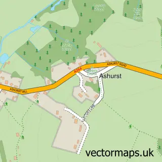
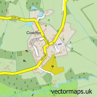
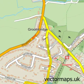
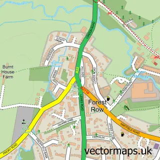
Nearby street map samples around Hartfield

More street maps in East Sussex
750 metre map area coverage
Boundary, postcode and point of interest information for the 750m x 750m rectangle centred on this sample map.
Boundaries containing map centre
Constituency: Sussex Weald Co Const
County: East Sussex County
District: Wealden District
Icb: NHS Surrey and Sussex ICB
Parish: Hartfield CP
Police Force: sussex
Postcode District: TN7
Postcode Sector: TN7 4
Ward: Hartfield Ward
Nearby boundaries intersecting sample
No additional intersecting boundaries found.
Postcode coverage
POI category counts
Church Cathedral: 3
Professional Services: 3
Cleaning Services: 2
Coffee Shop: 2
Cremation Services: 2
Elementary School: 2
Naturopathic Holistic: 2
Tea Room: 2
Appliance Manufacturer: 1
Automotive Services And Repair: 1
Sample points of interest
- Just Recycle IT
- Mike Colenutt
- Kat's Cakes
- Grafton Baptist Church of Hartfield VA
- KS Barbers
- The Lodge, Hartfield
- Nick the Butcher
- Stairs Farm Caravan & Camping site
- Hartfield Church together with Coleman's Hatch Church
- St Mary's Church
- The Parish Church Of St Mary The Virgin Hartfield
- Real Cleaners Hartfield
Create a larger editable map of Hartfield
This sample shows only a 750 metre area. To create a larger map of Hartfield, use our map builder to choose your own coverage area, add titles and download editable SVG, PDF and PNG files.
Create a custom map of Hartfield