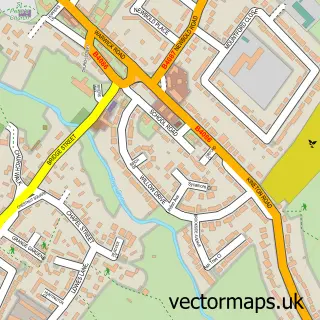
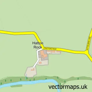
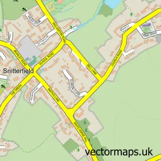
This Hampton Lucy street map is a detailed vector street map covering a 750m x 750m area. Select a larger area to create and download your own vector street map of Hampton Lucy.
The 750-metre map sample for Hampton Lucy covers 107 mapped buildings and approximately 14.9 km of road detail, of which 10 named roads are named. The immediate area includes 1 school, 1 GP surgery within 2 miles, 2 pubs and 3 MOT stations within 2 miles. The wider area around Hampton Lucy features 2 tourism points of interest, 2 food and drink venues and 1 campsite within 2 miles. To create a larger or custom map of Hampton Lucy, the map builder lets you define your own coverage area and download editable SVG, PDF and PNG files.
Create a larger editable map of Hampton Lucy
Choose any area you need and generate a high-quality vector map instantly. Perfect for print, planning, design, business and personal use.

This Hampton Lucy street map in Warwickshire is available as downloadable SVG, PDF and PNG map files, or as a printed map for planning, business, display, education, local information and design work. You can also create a larger custom map area using the map selector.
What this Hampton Lucy map sample shows
Hampton Lucy lies within Hampton Lucy Cp parish, part of Snitterfield ward in the Stratford-On-Avon District local authority area. The postcode geography for this area includes the CV postcode area, the CV35 postcode district and the CV35 8 postcode sector. Residents fall under the Nhs Coventry And Warwickshire Integrated Care Board for NHS services.
Local features near Hampton Lucy
Within 2 milesAmenities and services in and around Hampton Lucy.
Administrative and postcode information for Hampton Lucy
Hampton Lucy lies within Hampton Lucy Cp parish, part of Snitterfield ward in the Stratford-On-Avon District local authority area. The postcode geography for this area includes the CV postcode area, the CV35 postcode district and the CV35 8 postcode sector. Residents fall under the Nhs Coventry And Warwickshire Integrated Care Board for NHS services.
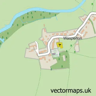
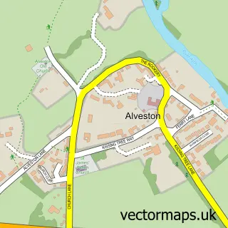
Nearby street map samples around Hampton Lucy

More street maps in Warwickshire
750 metre map area coverage
Boundary, postcode and point of interest information for the 750m x 750m rectangle centred on this sample map.
Boundaries containing map centre
Constituency: Stratford-on-Avon Co Const
County: Warwickshire County
District: Stratford-on-Avon District
Icb: NHS Coventry and Warwickshire ICB
Parish: Hampton Lucy CP
Police Force: warwickshire
Postcode District: CV35
Postcode Sector: CV35 8
Ward: Wellesbourne North & Rural Ward
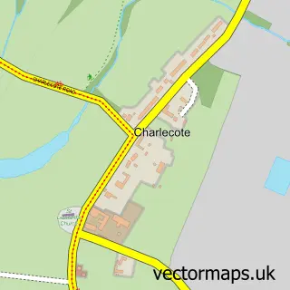
Nearby boundaries intersecting sample
Parish: Charlecote CP
Postcode Sector: CV35 9
Postcode coverage
POI category counts
Pub: 2
Anglican Church: 1
Beauty And Spa: 1
Building Supply Store: 1
Campground: 1
Church Cathedral: 1
Community Services Non Profits: 1
Doctor: 1
Elementary School: 1
Furniture Store: 1
Sample points of interest
- Hampton Lucy - St. Peter ad Vincula
- Body and Soul Therapies
- Asp Electrics
- Avon Riverside Glamping
- St Peter's Church
- British Angora Goats Society
- Help At Hand Care Service
- Hampton Lucy Primary School & Nursery
- Cupboard Love Design Ltd
- Barford Village Shop
- Stratford Skip Hire
- Charlecote Mill
Create a larger editable map of Hampton Lucy
This sample shows only a 750 metre area. To create a larger map of Hampton Lucy, use our map builder to choose your own coverage area, add titles and download editable SVG, PDF and PNG files.
Create a custom map of Hampton Lucy