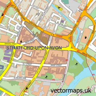
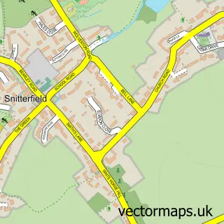
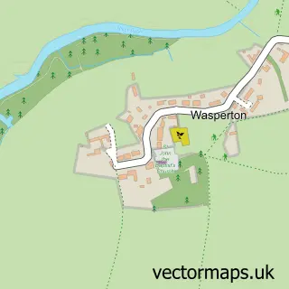
This Tiddington street map is a detailed vector street map covering a 750m x 750m area. Select a larger area to create and download your own vector street map of Tiddington.
The 750-metre map sample for Tiddington covers 200 mapped buildings and approximately 17.3 km of road detail, of which 11 named roads are named. The immediate area includes 3 GP surgeries within 2 miles, 1 pub and 11 MOT stations within 2 miles. The wider area around Tiddington features 4 food and drink venues and 4 hotels. To create a larger or custom map of Tiddington, the map builder lets you define your own coverage area and download editable SVG, PDF and PNG files.
Create a larger editable map of Tiddington
Choose any area you need and generate a high-quality vector map instantly. Perfect for print, planning, design, business and personal use.

This Tiddington street map in Warwickshire is available as downloadable SVG, PDF and PNG map files, or as a printed map for planning, business, display, education, local information and design work. You can also create a larger custom map area using the map selector.
What this Tiddington map sample shows
Tiddington lies within Stratford-Upon-Avon Cp parish, part of Tiddington ward in the Stratford-On-Avon District local authority area. The postcode geography for this area includes the CV postcode area, the CV37 postcode district and the CV37 7 postcode sector. Residents fall under the Nhs Coventry And Warwickshire Integrated Care Board for NHS services.
Local features near Tiddington
Within 2 milesAmenities and services in and around Tiddington.
Administrative and postcode information for Tiddington
The local authority covering Tiddington is Stratford-On-Avon District, within the county of Warwickshire. The settlement lies within Tiddington ward and Stratford-Upon-Avon Cp civil parish. The CV37 postcode district and CV37 7 postcode sector serve the immediate area. NHS provision in the area is delivered through South Warwickshire University Nhs Foundation Trust.
Nearby street map samples around Tiddington

More street maps in Warwickshire
750 metre map area coverage
Boundary, postcode and point of interest information for the 750m x 750m rectangle centred on this sample map.
Boundaries containing map centre
Constituency: Stratford-on-Avon Co Const
County: Warwickshire County
District: Stratford-on-Avon District
Icb: NHS Coventry and Warwickshire ICB
Parish: Stratford-upon-Avon CP
Police Force: warwickshire
Postcode District: CV37
Postcode Sector: CV37 7
Ward: Stratford Tiddington Ward
Nearby boundaries intersecting sample
Postcode Sector: CV37 0
Ward: Stratford Welcombe Ward
Postcode coverage
POI category counts
Hotel: 3
Hobby Shop: 2
Indian Restaurant: 2
Restaurant: 2
Sports Club And League: 2
Tapas Bar: 2
Asian Restaurant: 1
Assisted Living Facility: 1
Atms: 1
Auction House: 1
Sample points of interest
- Mr. Chan's
- Masonic Housing Association
- Spar Tiddington (Protected), Tiddington
- Bigwood Fine Art Auctioneers
- Wendy O'Hare Skin Care
- Louise Victoria Couture Bridal
- Martin Salt Photography
- Costa Express
- SPAR Tiddington
- Post Office Travel Money
- Joanne Harris Floral Design
- Creative Hair by Julie
Create a larger editable map of Tiddington
This sample shows only a 750 metre area. To create a larger map of Tiddington, use our map builder to choose your own coverage area, add titles and download editable SVG, PDF and PNG files.
Create a custom map of Tiddington