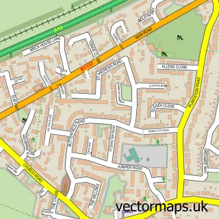
This Hatfield Peverel street map is a detailed vector street map covering a 750m x 750m area. Select a larger area to create and download your own vector street map of Hatfield Peverel.
The 750-metre map sample for Hatfield Peverel covers 660 mapped buildings and approximately 16.8 km of road detail, of which 37 named roads are named. The immediate area includes 4 pubs and 2 MOT stations within 2 miles. The wider area around Hatfield Peverel features 1 tourism point of interest and 7 food and drink venues. To create a larger or custom map of Hatfield Peverel, the map builder lets you define your own coverage area and download editable SVG, PDF and PNG files.
Create a larger editable map of Hatfield Peverel
Choose any area you need and generate a high-quality vector map instantly. Perfect for print, planning, design, business and personal use.

This Hatfield Peverel street map in Essex is available as downloadable SVG, PDF and PNG map files, or as a printed map for planning, business, display, education, local information and design work. You can also create a larger custom map area using the map selector.
What this Hatfield Peverel map sample shows
Hatfield Peverel lies within Hatfield Peverel Cp parish, part of Hatfield Peverel & Terling ward in the Braintree District local authority area. The postcode geography for this area includes the CM postcode area, the CM3 postcode district and the CM3 2 postcode sector. Residents fall under the Nhs Mid And South Essex Integrated Care Board for NHS services.
Local features near Hatfield Peverel
Within 2 milesAmenities and services in and around Hatfield Peverel.
Administrative and postcode information for Hatfield Peverel
Hatfield Peverel lies within Hatfield Peverel Cp parish, part of Hatfield Peverel & Terling ward in the Braintree District local authority area. The postcode geography for this area includes the CM postcode area, the CM3 postcode district and the CM3 2 postcode sector. Residents fall under the Nhs Mid And South Essex Integrated Care Board for NHS services.
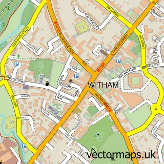
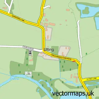
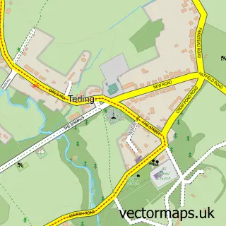
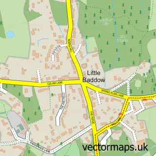
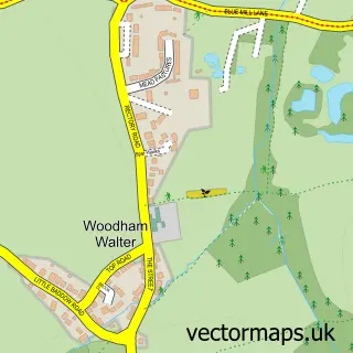
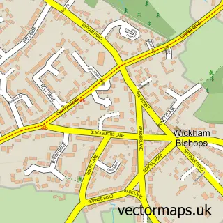
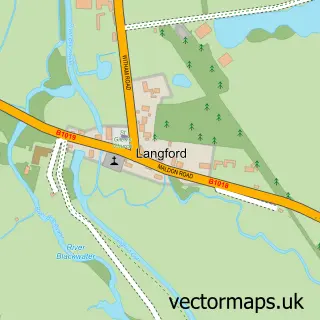
Nearby street map samples around Hatfield Peverel


More street maps in Essex
750 metre map area coverage
Boundary, postcode and point of interest information for the 750m x 750m rectangle centred on this sample map.
Boundaries containing map centre
Constituency: Witham Co Const
County: Essex County
District: Braintree District
Icb: NHS Essex ICB
Parish: Hatfield Peverel CP
Police Force: essex
Postcode District: CM3
Postcode Sector: CM3 2
Ward: Hatfield Peverel & Terling Ward
Nearby boundaries intersecting sample
No additional intersecting boundaries found.
Postcode coverage
POI category counts
Convenience Store: 4
Pub: 4
Real Estate Agent: 3
Barber: 2
Building Supply Store: 2
Community Center: 2
Electrician: 2
Indian Restaurant: 2
Pharmacy: 2
Supermarket: 2
Sample points of interest
- Helen Rollason Cancer Charity
- PayPoint
- RVS Assist
- Crumbs To Creations
- Parrs Barbers
- Tcut Traditional Barbers
- Tranquility Nail & Beauty Salon
- The Blue Strawberry Bistrot
- AJF LANDSCAPES
- Road Formations & Surfacing Ltd
- R J C
- D's Cafe Diner
Create a larger editable map of Hatfield Peverel
This sample shows only a 750 metre area. To create a larger map of Hatfield Peverel, use our map builder to choose your own coverage area, add titles and download editable SVG, PDF and PNG files.
Create a custom map of Hatfield Peverel