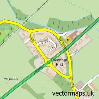
This Little Braxted street map is a detailed vector street map covering a 750m x 750m area. Select a larger area to create and download your own vector street map of Little Braxted.
The 750-metre map sample for Little Braxted covers 20 mapped buildings and approximately 3.7 km of road detail, of which 2 named roads are named. The immediate area includes 4 GP surgeries within 2 miles and 9 MOT stations within 2 miles. To create a larger or custom map of Little Braxted, the map builder lets you define your own coverage area and download editable SVG, PDF and PNG files.
Create a larger editable map of Little Braxted
Choose any area you need and generate a high-quality vector map instantly. Perfect for print, planning, design, business and personal use.

This Little Braxted street map in Essex is available as downloadable SVG, PDF and PNG map files, or as a printed map for planning, business, display, education, local information and design work. You can also create a larger custom map area using the map selector.
What this Little Braxted map sample shows
Little Braxted lies within Little Braxted Cp parish, part of Wickham Bishops And Woodham ward in the Maldon District (B) local authority area. The postcode geography for this area includes the CM postcode area, the CM8 postcode district and the CM8 3 postcode sector. Residents fall under the Nhs Mid And South Essex Integrated Care Board for NHS services.
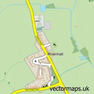
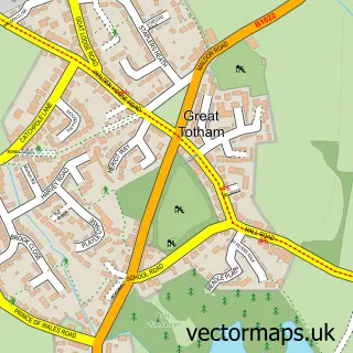
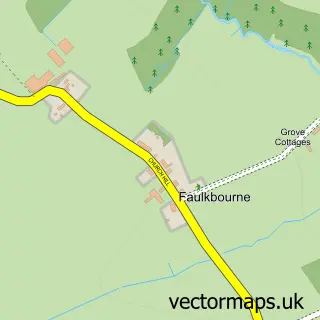
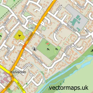
Local features near Little Braxted
Within 2 milesAmenities and services in and around Little Braxted.
Administrative and postcode information for Little Braxted
Little Braxted lies within Little Braxted Cp parish, part of Wickham Bishops And Woodham ward in the Maldon District (B) local authority area. The postcode geography for this area includes the CM postcode area, the CM8 postcode district and the CM8 3 postcode sector. Residents fall under the Nhs Mid And South Essex Integrated Care Board for NHS services.
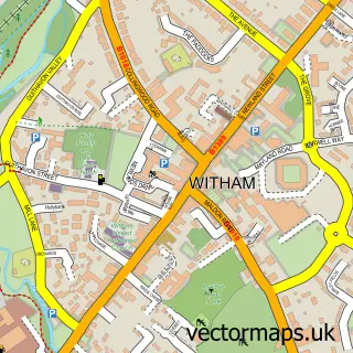
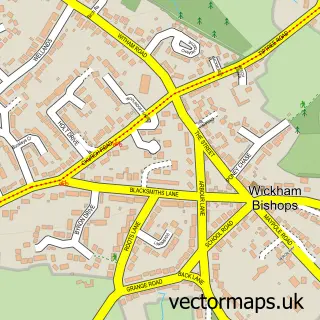
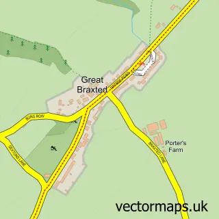
Nearby street map samples around Little Braxted


More street maps in Essex
750 metre map area coverage
Boundary, postcode and point of interest information for the 750m x 750m rectangle centred on this sample map.
Boundaries containing map centre
Constituency: Witham Co Const
County: Essex County
District: Maldon District (B)
Icb: NHS Essex ICB
Parish: Little Braxted CP
Police Force: essex
Postcode District: CM8
Postcode Sector: CM8 3
Ward: Wickham Bishops and Woodham Ward
Nearby boundaries intersecting sample
District: Braintree District
Parish: Great Braxted CP, Rivenhall CP, Witham CP
Ward: Great Totham Ward, Silver End & Cressing Ward, Witham Central Ward
Postcode coverage
POI category counts
Lake: 3
Insurance Agency: 2
Professional Services: 2
Anglican Church: 1
Business: 1
Business Management Services: 1
Church Cathedral: 1
Clothing Store: 1
Corporate Office: 1
Driving School: 1
Sample points of interest
- Little Braxted: St Nicholas
- HCPC Training
- Total Merchandise Ltd.
- St Nicholas' Church
- Headwear UK
- IMS International
- Kursy CPC
- Am Electrics DAC Ltd
- Parrett Financial Planning
- Coleman's Cottage Fishery
- Kit Speakman Marketing
- Bytes Document Solutions Ltd.
Create a larger editable map of Little Braxted
This sample shows only a 750 metre area. To create a larger map of Little Braxted, use our map builder to choose your own coverage area, add titles and download editable SVG, PDF and PNG files.
Create a custom map of Little Braxted