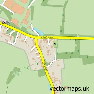
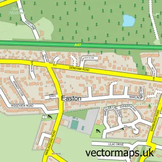
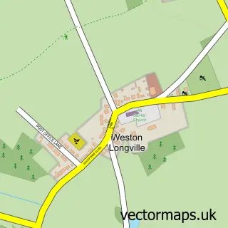
This Honingham street map is a detailed vector street map covering a 750m x 750m area. Select a larger area to create and download your own vector street map of Honingham.
The 750-metre map sample for Honingham covers 130 mapped buildings and approximately 10.3 km of road detail, of which 10 named roads are named. The immediate area includes 1 pub and 1 MOT station within 2 miles. The wider area around Honingham features 1 food and drink venue. To create a larger or custom map of Honingham, the map builder lets you define your own coverage area and download editable SVG, PDF and PNG files.
Create a larger editable map of Honingham
Choose any area you need and generate a high-quality vector map instantly. Perfect for print, planning, design, business and personal use.

This Honingham street map in Norfolk is available as downloadable SVG, PDF and PNG map files, or as a printed map for planning, business, display, education, local information and design work. You can also create a larger custom map area using the map selector.
What this Honingham map sample shows
Honingham lies within Honingham Cp parish, part of Great Witchingham ward in the Broadland District local authority area. The postcode geography for this area includes the NR postcode area, the NR9 postcode district and the NR9 5 postcode sector. Residents fall under the Nhs Norfolk And Waveney Integrated Care Board for NHS services.
Local features near Honingham
Within 2 milesAmenities and services in and around Honingham.
Administrative and postcode information for Honingham
The local authority covering Honingham is Broadland District, within the county of Norfolk. The settlement lies within Great Witchingham ward and Honingham Cp civil parish. The NR9 postcode district and NR9 5 postcode sector serve the immediate area. NHS provision in the area is delivered through Norfolk And Norwich University Hospitals Nhs Foundation Trust.
Nearby street map samples around Honingham

More street maps in Norfolk
750 metre map area coverage
Boundary, postcode and point of interest information for the 750m x 750m rectangle centred on this sample map.
Boundaries containing map centre
Constituency: Broadland and Fakenham Co Const
County: Norfolk County
District: Broadland District
Icb: NHS Norfolk and Waveney ICB
Parish: Honingham CP
Police Force: norfolk
Postcode District: NR9
Postcode Sector: NR9 5
Ward: Great Witchingham Ward
Nearby boundaries intersecting sample
No additional intersecting boundaries found.
Postcode coverage
POI category counts
Automotive Repair: 2
Anglican Church: 1
Architectural Designer: 1
Assisted Living Facility: 1
Bed And Breakfast: 1
Community Center: 1
Contractor: 1
Dance School: 1
Massage: 1
Naturopathic Holistic: 1
Sample points of interest
- Honingham: St Pauls Chapel
- Building Plans Ltd
- Ailwyn Hall Residential Care Home For the Elderly
- Andys Imports
- Os-carz
- The Honingham Buck
- Honingham Village Hall
- H Smith & Sons Honingham
- Norwich West Coast Swing
- Tracy Shanks Sports And Remedial Massage
- Blossom Therapies and Yoga
- Norfolk Property Care
Create a larger editable map of Honingham
This sample shows only a 750 metre area. To create a larger map of Honingham, use our map builder to choose your own coverage area, add titles and download editable SVG, PDF and PNG files.
Create a custom map of Honingham