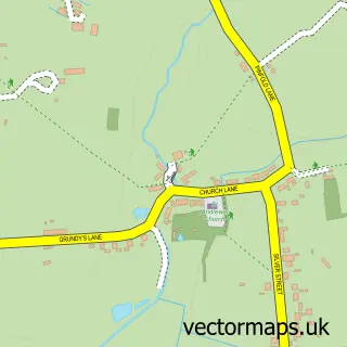
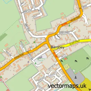
This Horsington street map is a detailed vector street map covering a 750m x 750m area. Select a larger area to create and download your own vector street map of Horsington.
The 750-metre map sample for Horsington covers 125 mapped buildings and approximately 6.6 km of road detail, of which 5 named roads are named. The immediate area includes 1 pub. The wider area around Horsington features 1 food and drink venue. To create a larger or custom map of Horsington, the map builder lets you define your own coverage area and download editable SVG, PDF and PNG files.
Create a larger editable map of Horsington
Choose any area you need and generate a high-quality vector map instantly. Perfect for print, planning, design, business and personal use.

This Horsington street map in Lincolnshire is available as downloadable SVG, PDF and PNG map files, or as a printed map for planning, business, display, education, local information and design work. You can also create a larger custom map area using the map selector.
What this Horsington map sample shows
Horsington lies within Horsington Cp parish, part of Roughton ward in the East Lindsey District local authority area. The postcode geography for this area includes the LN postcode area, the LN10 postcode district and the LN10 5 postcode sector. Residents fall under the Nhs Lincolnshire Integrated Care Board for NHS services.
Local features near Horsington
Within 2 milesAmenities and services in and around Horsington.
Administrative and postcode information for Horsington
Horsington lies within Horsington Cp parish, part of Roughton ward in the East Lindsey District local authority area. The postcode geography for this area includes the LN postcode area, the LN10 postcode district and the LN10 5 postcode sector. Residents fall under the Nhs Lincolnshire Integrated Care Board for NHS services.
Nearby street map samples around Horsington

More street maps in Lincolnshire
750 metre map area coverage
Boundary, postcode and point of interest information for the 750m x 750m rectangle centred on this sample map.
Boundaries containing map centre
Constituency: Louth and Horncastle Co Const
County: Lincolnshire County
District: East Lindsey District
Icb: NHS Lincolnshire ICB
Parish: Horsington CP
Police Force: lincolnshire
Postcode District: LN10
Postcode Sector: LN10 5
Ward: Roughton Ward
Nearby boundaries intersecting sample
No additional intersecting boundaries found.
Postcode coverage
POI category counts
Anglican Church: 1
Bar: 1
Chimney Sweep: 1
Community Services Non Profits: 1
Firewood: 1
Framing Store: 1
Furniture Store: 1
Home Service: 1
Outdoor Gear: 1
Patisserie Cake Shop: 1
Sample points of interest
- All Saints, Horsington
- Elder Tree Inn
- Sooty and Sweep Chimney Sweeping Services
- Charles Hill Community Hall Horsington
- R H Hill & Son
- The Stables Gallery
- Anything Wood Workshop
- Sooty & Sweep Chimney Sweep
- Charles H Hill Ltd
- Cakes by Beckie | Cupcakes And Celebration Cakes
- Elder Tree Inn
Create a larger editable map of Horsington
This sample shows only a 750 metre area. To create a larger map of Horsington, use our map builder to choose your own coverage area, add titles and download editable SVG, PDF and PNG files.
Create a custom map of Horsington