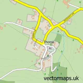
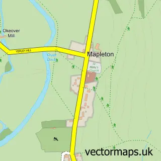
This Ilam street map is a detailed vector street map covering a 750m x 750m area. Select a larger area to create and download your own vector street map of Ilam.
The 750-metre map sample for Ilam covers 27 mapped buildings and approximately 17.4 km of road detail, of which 2 named roads are named. The immediate area includes 1 school and 1 MOT station within 2 miles. The wider area around Ilam features 5 tourism points of interest, 1 food and drink venue and 1 hotel. To create a larger or custom map of Ilam, the map builder lets you define your own coverage area and download editable SVG, PDF and PNG files.
Create a larger editable map of Ilam
Choose any area you need and generate a high-quality vector map instantly. Perfect for print, planning, design, business and personal use.

This Ilam street map in Staffordshire is available as downloadable SVG, PDF and PNG map files, or as a printed map for planning, business, display, education, local information and design work. You can also create a larger custom map area using the map selector.
What this Ilam map sample shows
Ilam lies within Ilam Cp parish, part of Hamps Valley ward in the Staffordshire Moorlands District local authority area. The postcode geography for this area includes the DE postcode area, the DE6 postcode district and the DE6 2 postcode sector. Residents fall under the Nhs Staffordshire And Stoke-On-Trent Integrated Care Board for NHS services.
Local features near Ilam
Within 2 milesAmenities and services in and around Ilam.
Administrative and postcode information for Ilam
Ilam lies within Ilam Cp parish, part of Hamps Valley ward in the Staffordshire Moorlands District local authority area. The postcode geography for this area includes the DE postcode area, the DE6 postcode district and the DE6 2 postcode sector. Residents fall under the Nhs Staffordshire And Stoke-On-Trent Integrated Care Board for NHS services.
Nearby street map samples around Ilam

More street maps in Staffordshire
750 metre map area coverage
Boundary, postcode and point of interest information for the 750m x 750m rectangle centred on this sample map.
Boundaries containing map centre
Constituency: Staffordshire Moorlands Co Const
County: Staffordshire County
District: Staffordshire Moorlands District
Icb: NHS Staffordshire and Stoke-on-Trent ICB
Parish: Ilam CP
Police Force: staffordshire
Postcode District: DE6
Postcode Sector: DE6 2
Ward: Hamps Valley Ward
Nearby boundaries intersecting sample
Parish: Blore with Swinscoe CP
Postcode coverage
POI category counts
Elementary School: 2
Hostel: 2
Tea Room: 2
Anglican Church: 1
Antique Store: 1
Attractions And Activities: 1
Cafe: 1
Campground: 1
Hotel: 1
Landmark And Historical Building: 1
Sample points of interest
- Ilam Holy Cross
- Tarvier
- Ilam Park, Dovedale and the White Peak
- Ilam Park Cafe
- Caravan Site
- Ilam C of E Primary School
- Ilam C of E VA Primary School
- Dovedale House
- YHA Ilam Hall
- Garden Farm B&B and Holiday Cottage
- Ilam
- Dovedale House
Create a larger editable map of Ilam
This sample shows only a 750 metre area. To create a larger map of Ilam, use our map builder to choose your own coverage area, add titles and download editable SVG, PDF and PNG files.
Create a custom map of Ilam