Vector Maps logo
Home Why it works Popular maps Districts Samples Customizer Create Your Map
VectorMaps.uk
Home Popular maps Districts Samples Customizer Create Your Map Privacy Disclaimer
Home / UK Maps / West Yorkshire / Ilkley Map

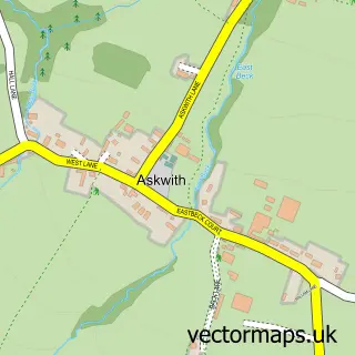
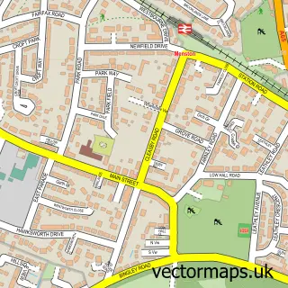
This Ilkley street map is a detailed vector street map covering a 750m x 750m area. Select a larger area to create and download your own vector street map of Ilkley.

Ilkley is a town in West Yorkshire, in the Yorkshire And The Humber of England. Historically, the area formed part of Yorkshire. The settlement falls within the Keighley parliamentary constituency. It is served by the LS29 postcode district, with LS29 9 a

The 750-metre map sample for Ilkley covers 263 mapped buildings and approximately 23.1 km of road detail, of which 69 named roads are named. The immediate area includes 1 railway station, 2 GP surgeries within 2 miles, 11 pubs and 1 MOT station, with 6 within 2 miles. The wider area around Ilkley features 5 tourism points of interest, 41 food and drink venues and 3 hotels. To create a larger or custom map of Ilkley, the map builder lets you define your own coverage area and download editable SVG, PDF and PNG files.

263Buildings
23.14 kmRoads
69Named roads
6,949Residents within 2 miles
Create your own

Create a larger editable map of Ilkley

Choose any area you need and generate a high-quality vector map instantly. Perfect for print, planning, design, business and personal use.

Choose any location
Editable SVG files
Any size up to A0
PDF, PNG & more
Instant download
High quality guaranteed
Create My Custom Map
Secure, private & no credit card required
Ilkley Vector Street Map
750m Sample
Ilkley vector street map sample showing roads, buildings and local features in a 750 metre preview area
Buy Ilkley Map Print from £12.95 Buy Ilkley Digital Map from £6

This Ilkley street map in West Yorkshire is available as downloadable SVG, PDF and PNG map files, or as a printed map for planning, business, display, education, local information and design work. You can also create a larger custom map area using the map selector.

What this Ilkley map sample shows

Ilkley lies within Ilkley Cp parish, part of Ilkley ward in the Bradford District (B) local authority area. The postcode geography for this area includes the LS postcode area, the LS29 postcode district and the LS29 9 postcode sector. Residents fall under the Nhs West Yorkshire Integrated Care Board for NHS services.

Local features near Ilkley

Within 2 miles

Amenities and services in and around Ilkley.

1 Railway stations
2 GP surgeries within 2 miles
1 MOT stations 6 within 2 miles
5 Tourism & leisure
41 Food & drink
11 Pubs
3 Hotels
13 Healthcare POIs
2 Vehicle services

Counts are approximate and based on publicly available data.

Administrative and postcode information for Ilkley

Ilkley lies within Ilkley Cp parish, part of Ilkley ward in the Bradford District (B) local authority area. The postcode geography for this area includes the LS postcode area, the LS29 postcode district and the LS29 9 postcode sector. Residents fall under the Nhs West Yorkshire Integrated Care Board for NHS services.

Parish Ilkley CP
Ward Ilkley
District / local authority Bradford District (B)
County West Yorkshire
Historic county Yorkshire
Postcode district LS29
Postcode sector LS29 9
Parliamentary constituency Keighley
Region Yorkshire and the Humber
Country England

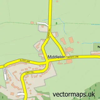
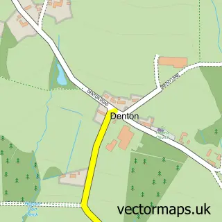
Nearby street map samples around Ilkley

Street map sample of Bradford, West Yorkshire Bradford City - West Yorkshire - 9.5 miles Street map sample of Middleton, North Yorkshire Middleton Village - North Yorkshire - 1.0 miles Street map sample of Denton, North Yorkshire Denton Village - North Yorkshire - 1.8 miles Street map sample of Addingham, West Yorkshire Addingham Village - West Yorkshire - 2.8 miles Street map sample of Burley-in-Wharfedale, West Yorkshire Burley-in-Wharfedale Village - West Yorkshire - 3.2 miles Street map sample of Askwith, North Yorkshire Askwith Village - North Yorkshire - 3.3 miles Street map sample of East Morton, West Yorkshire East Morton Village - West Yorkshire - 3.8 miles Street map sample of Riddlesden, West Yorkshire Riddlesden Village - West Yorkshire - 4.1 miles Street map sample of Sandbeds, West Yorkshire Sandbeds Village - West Yorkshire - 4.2 miles Street map sample of Menston, West Yorkshire Menston Village - West Yorkshire - 4.3 miles

More street maps in West Yorkshire

Street map sample of Addingham, West Yorkshire Addingham Village - 2.8 miles Street map sample of Burley-in-Wharfedale, West Yorkshire Burley-in-Wharfedale Village - 3.2 miles Street map sample of East Morton, West Yorkshire East Morton Village - 3.8 miles Street map sample of Riddlesden, West Yorkshire Riddlesden Village - 4.1 miles Street map sample of Sandbeds, West Yorkshire Sandbeds Village - 4.2 miles

750 metre map area coverage

Boundary, postcode and point of interest information for the 750m x 750m rectangle centred on this sample map.

Boundaries containing map centre

Constituency: Keighley and Ilkley Co Const

District: Bradford District (B)

Icb: NHS West Yorkshire ICB

Parish: Ilkley CP

Police Force: west yorkshire

Postcode District: LS29

Postcode Sector: LS29 9

Ward: Ilkley Ward

Nearby boundaries intersecting sample

Postcode Sector: LS29 0, LS29 8

Postcode coverage

LS29 LS29 9 LS29 0 LS29 8

POI category counts

Professional Services: 18

Hair Salon: 17

Clothing Store: 15

Restaurant: 13

Furniture Store: 11

Pub: 11

Real Estate Agent: 11

Beauty Salon: 10

Womens Clothing Store: 10

Advertising Agency: 9

Sample points of interest

  • Ascentis Accountants LLP Accountant
  • TaxAssist Accountants Accountant
  • Ilkley Memorial Gardens Active Life
  • Allied Print Advertising Agency
  • Ash Marketing Advertising Agency
  • Black Lab Digital Advertising Agency
  • Blueprint Marketing Services Advertising Agency
  • Improve Agency Advertising Agency
  • Pinnacle Graphic Design Advertising Agency
  • Tarn Design Advertising Agency
  • Wools of New Zealand Advertising Agency
  • Zebra Square Advertising Agency

Create a larger editable map of Ilkley

This sample shows only a 750 metre area. To create a larger map of Ilkley, use our map builder to choose your own coverage area, add titles and download editable SVG, PDF and PNG files.

Create a custom map of Ilkley

Phone 01751 473136 | Copyright Vectormaps.uk 2026

Samples Customizer Privacy Disclaimer
Ilkley Vector Street Map
Ilkley enlarged street map sample showing a 750 metre preview area