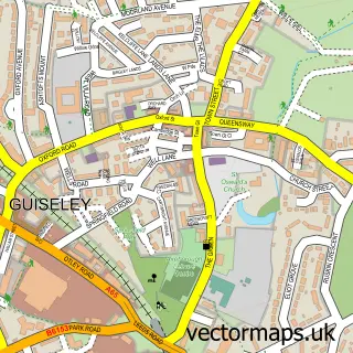
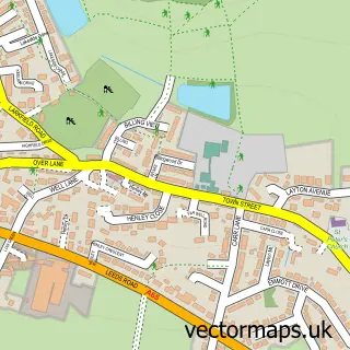
This Menston street map is a detailed vector street map covering a 750m x 750m area. Select a larger area to create and download your own vector street map of Menston.
The 750-metre map sample for Menston covers 535 mapped buildings and approximately 18.7 km of road detail, of which 51 named roads are named. The immediate area includes 1 railway station, 3 GP surgeries within 2 miles and 6 MOT stations within 2 miles. The wider area around Menston features 1 tourism point of interest and 1 campsite within 2 miles. To create a larger or custom map of Menston, the map builder lets you define your own coverage area and download editable SVG, PDF and PNG files.
Create a larger editable map of Menston
Choose any area you need and generate a high-quality vector map instantly. Perfect for print, planning, design, business and personal use.

This Menston street map in West Yorkshire is available as downloadable SVG, PDF and PNG map files, or as a printed map for planning, business, display, education, local information and design work. You can also create a larger custom map area using the map selector.
What this Menston map sample shows
Menston lies within Menston Cp parish, part of Wharfedale ward in the Bradford District (B) local authority area. The postcode geography for this area includes the LS postcode area, the LS29 postcode district and the LS29 6 postcode sector. Residents fall under the Nhs West Yorkshire Integrated Care Board for NHS services.
Local features near Menston
Within 2 milesAmenities and services in and around Menston.
Administrative and postcode information for Menston
The local authority covering Menston is Bradford District (B), within the county of West Yorkshire. The settlement lies within Wharfedale ward and Menston Cp civil parish. The LS29 postcode district and LS29 6 postcode sector serve the immediate area. NHS provision in the area is delivered through Leeds Teaching Hospitals Nhs Trust.
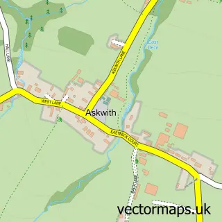
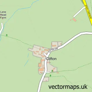
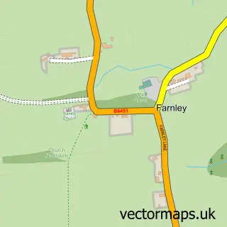
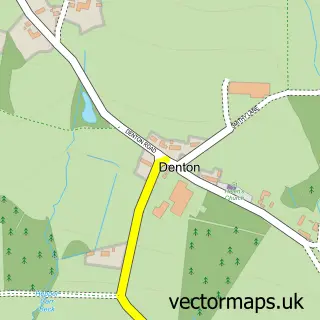
Nearby street map samples around Menston

More street maps in West Yorkshire
750 metre map area coverage
Boundary, postcode and point of interest information for the 750m x 750m rectangle centred on this sample map.
Boundaries containing map centre
Constituency: Shipley Co Const
District: Bradford District (B)
Icb: NHS West Yorkshire ICB
Parish: Menston CP
Police Force: west yorkshire
Postcode District: LS29
Postcode Sector: LS29 6
Ward: Wharfedale Ward
Nearby boundaries intersecting sample
Constituency: Leeds North West Co Const
District: Leeds District (B)
Ward: Guiseley & Rawdon Ward
Postcode coverage
POI category counts
Driving School: 4
Beauty Salon: 3
Convenience Store: 3
Pilates Studio: 3
Professional Services: 3
Business Management Services: 2
Dance School: 2
Package Locker: 2
Physical Therapy: 2
Train Station: 2
Sample points of interest
- Pro Flight Golf
- The Abbeyfield Dales
- Your Seamstress
- Altea Hairdressing.
- Clare Armstrong and Co
- Cutaway
- The Wharfedale Skin Clinic
- The Fox in Menston
- Bauerdecking Limited
- Menston Post Office
- Post Office-Menston
- Wheelin' Wood
Create a larger editable map of Menston
This sample shows only a 750 metre area. To create a larger map of Menston, use our map builder to choose your own coverage area, add titles and download editable SVG, PDF and PNG files.
Create a custom map of Menston