Vector Maps logo
Home Why it works Popular maps Districts Samples Customizer Create Your Map
VectorMaps.uk
Home Popular maps Districts Samples Customizer Create Your Map Privacy Disclaimer
Home / UK Maps / Inverness / Inverie Map

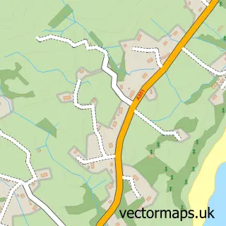
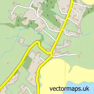
This Inverie street map is a detailed vector street map covering a 750m x 750m area. Select a larger area to create and download your own vector street map of Inverie.

Inverie is a village in Inverness, in the Highlands And Islands of Scotland. Historically, the area formed part of Inverness-Shire. The settlement falls within the Ross, Skye And Lochaber parliamentary constituency.

The 750-metre map sample for Inverie covers 32 mapped buildings and approximately 12.6 km of road detail, of which 1 named road are named. The immediate area includes 3 pubs. The wider area around Inverie features 3 food and drink venues, 1 hotel and 1 campsite within 2 miles. To create a larger or custom map of Inverie, the map builder lets you define your own coverage area and download editable SVG, PDF and PNG files.

32Buildings
12.63 kmRoads
1Named roads
0Residents within 2 miles
Create your own

Create a larger editable map of Inverie

Choose any area you need and generate a high-quality vector map instantly. Perfect for print, planning, design, business and personal use.

Choose any location
Editable SVG files
Any size up to A0
PDF, PNG & more
Instant download
High quality guaranteed
Create My Custom Map
Secure, private & no credit card required
Inverie Vector Street Map
750m Sample
Inverie vector street map sample showing roads, buildings and local features in a 750 metre preview area
Buy Inverie Map Print from £12.95 Buy Inverie Digital Map from £6

This Inverie street map in Inverness is available as downloadable SVG, PDF and PNG map files, or as a printed map for planning, business, display, education, local information and design work. You can also create a larger custom map area using the map selector.

What this Inverie map sample shows

Inverie lies within Highland parish, part of Caol And Mallaig ward in the Highland local authority area. Residents fall under the Highland for NHS services.

Local features near Inverie

Within 2 miles

Amenities and services in and around Inverie.

1 Campsites within 2 miles
3 Food & drink
3 Pubs
1 Hotels

Counts are approximate and based on publicly available data.

Administrative and postcode information for Inverie

Inverie lies within Highland parish, part of Caol And Mallaig ward in the Highland local authority area. Residents fall under the Highland for NHS services.

Parish HIGHLAND
Ward Caol and Mallaig
District / local authority Highland
County Inverness
Historic county Inverness-shire
Parliamentary constituency Ross, Skye and Lochaber
Region Highlands and Islands
Country Scotland

Nearby street map samples around Inverie

Street map sample of Fort William, Inverness Fort William Town - Inverness - 26.5 miles Street map sample of Inverness, Inverness Inverness City - Inverness - 62.5 miles Street map sample of Mallaig, Inverness Mallaig Village - Inverness - 5.9 miles Street map sample of Mòrar, Inverness Mòrar Village - Inverness - 7.0 miles Street map sample of A' Chill Bheag, Ross and Cromarty A' Chill Bheag Village - Ross and Cromarty - 7.9 miles Street map sample of Fearann Dòmhnaill, Ross and Cromarty Fearann Dòmhnaill Village - Ross and Cromarty - 8.0 miles Street map sample of Sàsaig, Ross and Cromarty Sàsaig Village - Ross and Cromarty - 8.0 miles Street map sample of Teang, Ross and Cromarty Teang Village - Ross and Cromarty - 8.2 miles Street map sample of Armadal, Ross and Cromarty Armadal Village - Ross and Cromarty - 8.2 miles Street map sample of Camas Cros, Ross and Cromarty Camas Cros Village - Ross and Cromarty - 8.2 miles

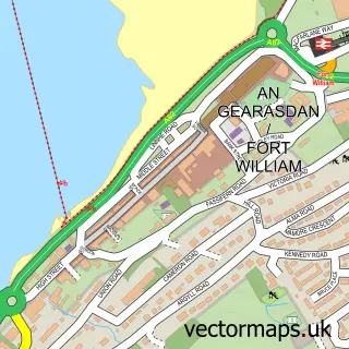
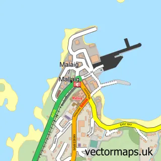
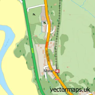
More street maps in Inverness

Street map sample of Mallaig, Inverness Mallaig Village - 5.9 miles Street map sample of Mòrar, Inverness Mòrar Village - 7.0 miles Street map sample of Arisaig, Inverness Arisaig Village - 10.6 miles Street map sample of Lochailort, Inverness Lochailort Village - 11.1 miles Street map sample of Glenfinnan, Inverness Glenfinnan Village - 14.7 miles

750 metre map area coverage

Boundary, postcode and point of interest information for the 750m x 750m rectangle centred on this sample map.

Boundaries containing map centre

Constituency: Inverness, Skye and West Ross-shire Co Const

District: Highland

Icb: Highland

Postcode District: PH41

Postcode Sector: PH41 4

Ward: Caol and Mallaig Ward

Nearby boundaries intersecting sample

No additional intersecting boundaries found.

Postcode coverage

PH41 PH41 4

POI category counts

Pub: 3

Bed And Breakfast: 1

Community Services Non Profits: 1

Cottage: 1

Farm: 1

Ferry Boat Company: 1

Grocery Store: 1

Gym: 1

Hotel: 1

Post Office: 1

Sample points of interest

  • The Gathering Knoydart Bed And Breakfast
  • Knoydart Foundation Shop Community Services Non Profits
  • Knoydart House Luxury Accommodation Cottage
  • Knoydart Farm Farm
  • Inverie Ferry Boat Company
  • The SHOP - Knoydart Grocery Store
  • Knoydart Foundation Ranger Service Gym
  • Knoydart Hide Luxury Accommodation Hotel
  • Knoydart Post Office Post Office
  • Old Forge Pub
  • The Old Forge Pub
  • The Table Pub

Create a larger editable map of Inverie

This sample shows only a 750 metre area. To create a larger map of Inverie, use our map builder to choose your own coverage area, add titles and download editable SVG, PDF and PNG files.

Create a custom map of Inverie

Phone 01751 473136 | Copyright Vectormaps.uk 2026

Samples Customizer Privacy Disclaimer
Inverie Vector Street Map
Inverie enlarged street map sample showing a 750 metre preview area