Vector Maps logo
Home Why it works Popular maps Districts Samples Customizer Create Your Map
VectorMaps.uk
Home Popular maps Districts Samples Customizer Create Your Map Privacy Disclaimer
Home / UK Maps / Inverness / Mòrar Map

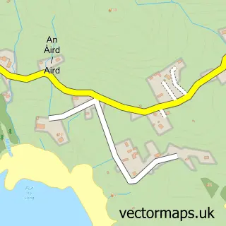
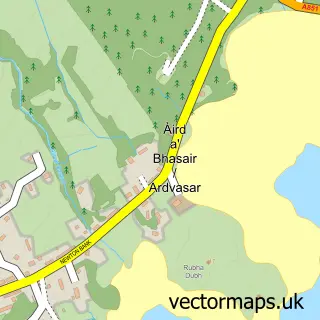
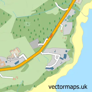
This Mòrar street map is a detailed vector street map covering a 750m x 750m area. Select a larger area to create and download your own vector street map of Mòrar.

Mòrar is a village in Inverness, in the Highlands And Islands of Scotland. Historically, the area formed part of Inverness-Shire. The settlement falls within the Ross, Skye And Lochaber parliamentary constituency. It is served by the PH40 postcode distric

The 750-metre map sample for Mòrar covers 43 mapped buildings and approximately 4.9 km of road detail, of which 1 named road are named. The immediate area includes 1 railway station and 1 MOT station. The wider area around Mòrar features 2 food and drink venues and 3 hotels. To create a larger or custom map of Mòrar, the map builder lets you define your own coverage area and download editable SVG, PDF and PNG files.

43Buildings
4.88 kmRoads
1Named roads
0Residents within 2 miles
Create your own

Create a larger editable map of Mòrar

Choose any area you need and generate a high-quality vector map instantly. Perfect for print, planning, design, business and personal use.

Choose any location
Editable SVG files
Any size up to A0
PDF, PNG & more
Instant download
High quality guaranteed
Create My Custom Map
Secure, private & no credit card required
Mòrar Vector Street Map
750m Sample
Mòrar vector street map sample showing roads, buildings and local features in a 750 metre preview area
Buy Mòrar Map Print from £12.95 Buy Mòrar Digital Map from £6

This Mòrar street map in Inverness is available as downloadable SVG, PDF and PNG map files, or as a printed map for planning, business, display, education, local information and design work. You can also create a larger custom map area using the map selector.

What this Mòrar map sample shows

Mòrar lies within Highland parish, part of Caol And Mallaig ward in the Highland local authority area. The postcode geography for this area includes the PH postcode area, the PH40 postcode district and the PH40 4 postcode sector. Residents fall under the Highland for NHS services.

Local features near Mòrar

Within 2 miles

Amenities and services in and around Mòrar.

1 Railway stations
1 MOT stations 1 within 2 miles
2 Food & drink
3 Hotels
1 Vehicle services

Counts are approximate and based on publicly available data.

Administrative and postcode information for Mòrar

The local authority covering Mòrar is Highland, within the county of Inverness. The settlement lies within Caol And Mallaig ward and Highland civil parish. The PH40 postcode district and PH40 4 postcode sector serve the immediate area. NHS provision in the area is delivered through Highland.

Parish HIGHLAND
Ward Caol and Mallaig
District / local authority Highland
County Inverness
Historic county Inverness-shire
Postcode district PH40
Postcode sector PH40 4
Parliamentary constituency Ross, Skye and Lochaber
Region Highlands and Islands
Country Scotland

Nearby street map samples around Mòrar

Street map sample of Tobermory, Argyll and Bute Tobermory Town - Argyll and Bute - 25.8 miles Street map sample of Inverness, Inverness Inverness City - Inverness - 69.3 miles Street map sample of Mallaig, Inverness Mallaig Village - Inverness - 2.5 miles Street map sample of Arisaig, Inverness Arisaig Village - Inverness - 4.2 miles Street map sample of Àird Shlèite, Ross and Cromarty Àird Shlèite Village - Ross and Cromarty - 6.9 miles Street map sample of Àird a' Bhàsair, Ross and Cromarty Àird a' Bhàsair Village - Ross and Cromarty - 6.9 miles Street map sample of Cailigearraidh, Ross and Cromarty Cailigearraidh Village - Ross and Cromarty - 6.9 miles Street map sample of Inverie, Inverness Inverie Village - Inverness - 7.0 miles Street map sample of Armadal, Ross and Cromarty Armadal Village - Ross and Cromarty - 7.2 miles Street map sample of A' Chill Bheag, Ross and Cromarty A' Chill Bheag Village - Ross and Cromarty - 8.3 miles

More street maps in Inverness

Street map sample of Mallaig, Inverness Mallaig Village - 2.5 miles Street map sample of Arisaig, Inverness Arisaig Village - 4.2 miles Street map sample of Inverie, Inverness Inverie Village - 7.0 miles Street map sample of Lochailort, Inverness Lochailort Village - 8.8 miles Street map sample of Glenuig, Inverness Glenuig Village - 9.9 miles

750 metre map area coverage

Boundary, postcode and point of interest information for the 750m x 750m rectangle centred on this sample map.

Boundaries containing map centre

Constituency: Inverness, Skye and West Ross-shire Co Const

District: Highland

Icb: Highland

Postcode District: PH40

Postcode Sector: PH40 4

Ward: Caol and Mallaig Ward

Nearby boundaries intersecting sample

No additional intersecting boundaries found.

Postcode coverage

PH40 PH40 4

POI category counts

Train Station: 4

Hotel: 3

Restaurant: 2

Automotive Repair: 1

Car Rental Agency: 1

Cottage: 1

Monument: 1

Print Media: 1

Sports And Recreation Venue: 1

Structure And Geography: 1

Sample points of interest

  • Morar Motors Ltd Automotive Repair
  • Morar Motors Car Rental Agency
  • Half Moon Bay - Sara and Gordon Cook Cottage
  • Morar Hotel Hotel
  • Taigh Na Talia Hotel
  • The Morar Hotel Hotel
  • The Morar Cross Monument
  • West Word Community Newspaper Print Media
  • Afternoon Tea at the Morar Hotel Restaurant
  • The Silver Sands Restaurant Restaurant
  • Loch Morar, Scotland Sports And Recreation Venue
  • Morar, Highlands of Scotland Structure And Geography

Create a larger editable map of Mòrar

This sample shows only a 750 metre area. To create a larger map of Mòrar, use our map builder to choose your own coverage area, add titles and download editable SVG, PDF and PNG files.

Create a custom map of Mòrar

Phone 01751 473136 | Copyright Vectormaps.uk 2026

Samples Customizer Privacy Disclaimer
Mòrar Vector Street Map
Mòrar enlarged street map sample showing a 750 metre preview area