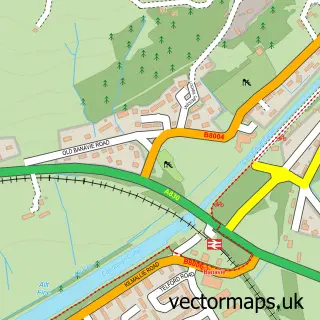
This Inverroy street map is a detailed vector street map covering a 750m x 750m area. Select a larger area to create and download your own vector street map of Inverroy.
The 750-metre map sample for Inverroy covers 62 mapped buildings and approximately 10.6 km of road detail. The wider area around Inverroy features 1 tourism point of interest and 1 campsite within 2 miles. To create a larger or custom map of Inverroy, the map builder lets you define your own coverage area and download editable SVG, PDF and PNG files.
Create a larger editable map of Inverroy
Choose any area you need and generate a high-quality vector map instantly. Perfect for print, planning, design, business and personal use.

This Inverroy street map in Inverness is available as downloadable SVG, PDF and PNG map files, or as a printed map for planning, business, display, education, local information and design work. You can also create a larger custom map area using the map selector.
What this Inverroy map sample shows
Inverroy lies within Highland parish, part of Caol And Mallaig ward in the Highland local authority area. The postcode geography for this area includes the PH postcode area, the PH31 postcode district and the PH31 4 postcode sector. Residents fall under the Highland for NHS services.
Local features near Inverroy
Within 2 milesAmenities and services in and around Inverroy.
Administrative and postcode information for Inverroy
Inverroy lies within Highland parish, part of Caol And Mallaig ward in the Highland local authority area. The postcode geography for this area includes the PH postcode area, the PH31 postcode district and the PH31 4 postcode sector. Residents fall under the Highland for NHS services.
Nearby street map samples around Inverroy


More street maps in Inverness
750 metre map area coverage
Boundary, postcode and point of interest information for the 750m x 750m rectangle centred on this sample map.
Boundaries containing map centre
Constituency: Inverness, Skye and West Ross-shire Co Const
District: Highland
Icb: Highland
Postcode District: PH31
Postcode Sector: PH31 4
Ward: Caol and Mallaig Ward
Nearby boundaries intersecting sample
Postcode District: PH34
Postcode Sector: PH34 4
Postcode coverage
POI category counts
Lodge: 2
Land Surveying: 1
Landmark And Historical Building: 1
Musical Instrument Store: 1
Self Catering Accommodation: 1
Sample points of interest
- Stuart Ross Scotland
- Inverroy
- Brae Lodges
- Orion lodge
- Caerini Violins
- Allt Mor Self Catering
Create a larger editable map of Inverroy
This sample shows only a 750 metre area. To create a larger map of Inverroy, use our map builder to choose your own coverage area, add titles and download editable SVG, PDF and PNG files.
Create a custom map of Inverroy