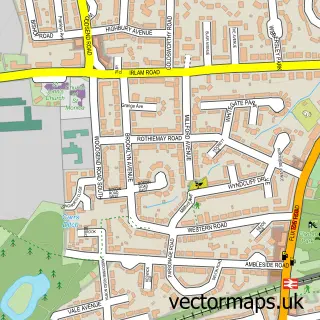
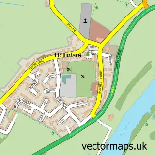
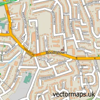
This Irlam street map is a detailed vector street map covering a 750m x 750m area. Select a larger area to create and download your own vector street map of Irlam.
The 750-metre map sample for Irlam covers 569 mapped buildings and approximately 17.8 km of road detail, of which 49 named roads are named. The immediate area includes 1 school, 2 GP surgeries, with 4 within 2 miles and 9 MOT stations within 2 miles. To create a larger or custom map of Irlam, the map builder lets you define your own coverage area and download editable SVG, PDF and PNG files.
Create a larger editable map of Irlam
Choose any area you need and generate a high-quality vector map instantly. Perfect for print, planning, design, business and personal use.

This Irlam street map in Greater Manchester is available as downloadable SVG, PDF and PNG map files, or as a printed map for planning, business, display, education, local information and design work. You can also create a larger custom map area using the map selector.
What this Irlam map sample shows
Irlam lies within Salford District (B) parish, part of Cadishead ward in the Salford District (B) local authority area. The postcode geography for this area includes the M postcode area, the M44 postcode district and the M44 6 postcode sector. Residents fall under the Nhs Greater Manchester Integrated Care Board for NHS services.
Local features near Irlam
Within 2 milesAmenities and services in and around Irlam.
Administrative and postcode information for Irlam
The local authority covering Irlam is Salford District (B), within the county of Greater Manchester. The settlement lies within Cadishead ward and Salford District (B) civil parish. The M44 postcode district and M44 6 postcode sector serve the immediate area. NHS provision in the area is delivered through Northern Care Alliance Nhs Foundation Trust.
Nearby street map samples around Irlam

More street maps in Greater Manchester
750 metre map area coverage
Boundary, postcode and point of interest information for the 750m x 750m rectangle centred on this sample map.
Boundaries containing map centre
Constituency: Worsley and Eccles Co Const
District: Salford District (B)
Icb: NHS Greater Manchester ICB
Police Force: greater manchester
Postcode District: M44
Postcode Sector: M44 6
Ward: Cadishead & Lower Irlam Ward
Nearby boundaries intersecting sample
Postcode Sector: M44 5
Ward: Higher Irlam & Peel Green Ward
Postcode coverage
POI category counts
Tattoo And Piercing: 4
Beauty Salon: 3
Doctor: 2
Alternative Medicine: 1
Anglican Church: 1
Barber: 1
Beauty And Spa: 1
Building Supply Store: 1
Business Manufacturing And Supply: 1
Carpenter: 1
Sample points of interest
- Irlam Osteopathic Clinic
- St John the Baptist
- Aram Barbers
- By Stevie Beauty
- Aram Barbers Limited
- Beautifique Irlam
- The Regency Salon
- Super Clean
- Manchester Garage Doors Ltd
- RGS staircases & joinery
- The Chocolate Box by Charlotte
- St John the Baptist Church
Create a larger editable map of Irlam
This sample shows only a 750 metre area. To create a larger map of Irlam, use our map builder to choose your own coverage area, add titles and download editable SVG, PDF and PNG files.
Create a custom map of Irlam