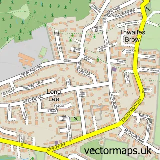
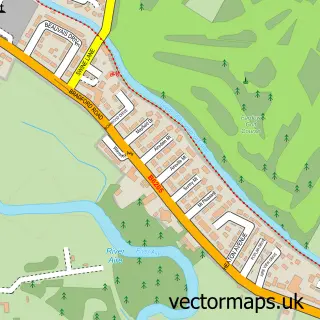
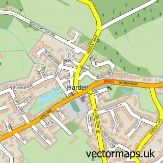
This Keighley street map is a detailed vector street map covering a 750m x 750m area. Select a larger area to create and download your own vector street map of Keighley.
The 750-metre map sample for Keighley covers 169 mapped buildings and approximately 19.0 km of road detail, of which 69 named roads are named. The immediate area includes 1 railway station, 1 GP surgery within 2 miles, 6 pubs and 4 MOT stations, with 27 within 2 miles. The wider area around Keighley features 2 tourism points of interest, 24 food and drink venues and 1 hotel. To create a larger or custom map of Keighley, the map builder lets you define your own coverage area and download editable SVG, PDF and PNG files.
Create a larger editable map of Keighley
Choose any area you need and generate a high-quality vector map instantly. Perfect for print, planning, design, business and personal use.

This Keighley street map in West Yorkshire is available as downloadable SVG, PDF and PNG map files, or as a printed map for planning, business, display, education, local information and design work. You can also create a larger custom map area using the map selector.
What this Keighley map sample shows
Keighley lies within Keighley Cp parish, part of Keighley Central ward in the Bradford District (B) local authority area. The postcode geography for this area includes the BD postcode area, the BD21 postcode district and the BD21 1 postcode sector. Residents fall under the Nhs West Yorkshire Integrated Care Board for NHS services.
Local features near Keighley
Within 2 milesAmenities and services in and around Keighley.
Administrative and postcode information for Keighley
The local authority covering Keighley is Bradford District (B), within the county of West Yorkshire. The settlement lies within Keighley Central ward and Keighley Cp civil parish. The BD21 postcode district and BD21 1 postcode sector serve the immediate area. NHS provision in the area is delivered through Airedale Nhs Foundation Trust.
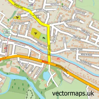
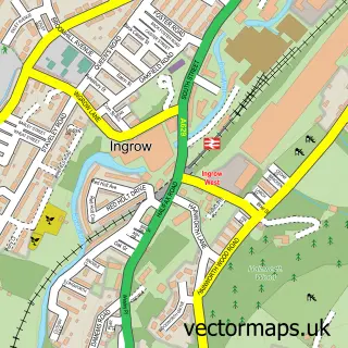
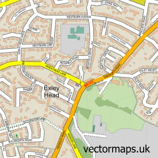
Nearby street map samples around Keighley

More street maps in West Yorkshire
750 metre map area coverage
Boundary, postcode and point of interest information for the 750m x 750m rectangle centred on this sample map.
Boundaries containing map centre
Constituency: Keighley and Ilkley Co Const
District: Bradford District (B)
Icb: NHS West Yorkshire ICB
Parish: Keighley CP
Police Force: west yorkshire
Postcode District: BD21
Postcode Sector: BD21 4
Ward: Keighley Central Ward
Nearby boundaries intersecting sample
Postcode Sector: BD21 2, BD21 3, BD21 5
Ward: Keighley East Ward
Postcode coverage
POI category counts
Beauty Salon: 16
Hair Salon: 14
Automotive Repair: 11
Fast Food Restaurant: 11
Flowers And Gifts Shop: 9
Building Supply Store: 8
Cafe: 8
Clothing Store: 8
Supermarket: 8
Charity Organization: 7
Sample points of interest
- Burrow & Crowe Accountants & Business Advisers Ltd
- ACU & HERBS • Chinese Acupuncture Clinic
- ACU & Herbs Keighely
- Acu & Herbs
- Dr&Herbs
- Direct Training
- AGM Colour
- Winners
- City Electrical Factors Ltd. (CEF)
- Pennine Plus
- The Vacuum Shop
- Little Nomad
Create a larger editable map of Keighley
This sample shows only a 750 metre area. To create a larger map of Keighley, use our map builder to choose your own coverage area, add titles and download editable SVG, PDF and PNG files.
Create a custom map of Keighley