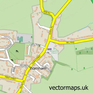
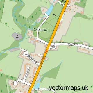
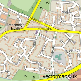
This Kingsfold street map is a detailed vector street map covering a 750m x 750m area. Select a larger area to create and download your own vector street map of Kingsfold.
The 750-metre map sample for Kingsfold covers 86 mapped buildings and approximately 4.8 km of road detail, of which 6 named roads are named. The immediate area includes 1 pub. The wider area around Kingsfold features 1 food and drink venue. To create a larger or custom map of Kingsfold, the map builder lets you define your own coverage area and download editable SVG, PDF and PNG files.
Create a larger editable map of Kingsfold
Choose any area you need and generate a high-quality vector map instantly. Perfect for print, planning, design, business and personal use.

This Kingsfold street map in West Sussex is available as downloadable SVG, PDF and PNG map files, or as a printed map for planning, business, display, education, local information and design work. You can also create a larger custom map area using the map selector.
What this Kingsfold map sample shows
Kingsfold lies within Warnham Cp parish, part of Itchingfield, Slinfold & Warnham ward in the Horsham District local authority area. The postcode geography for this area includes the RH postcode area, the RH12 postcode district and the RH12 3 postcode sector. Residents fall under the Nhs Sussex Integrated Care Board for NHS services.
Local features near Kingsfold
Within 2 milesAmenities and services in and around Kingsfold.
Administrative and postcode information for Kingsfold
The local authority covering Kingsfold is Horsham District, within the county of West Sussex. The settlement lies within Itchingfield, Slinfold & Warnham ward and Warnham Cp civil parish. The RH12 postcode district and RH12 3 postcode sector serve the immediate area. NHS provision in the area is delivered through Surrey And Sussex Healthcare Nhs Trust.
Nearby street map samples around Kingsfold

More street maps in West Sussex
750 metre map area coverage
Boundary, postcode and point of interest information for the 750m x 750m rectangle centred on this sample map.
Boundaries containing map centre
Constituency: Horsham Co Const
County: West Sussex County
District: Horsham District
Icb: NHS Surrey and Sussex ICB
Parish: Warnham CP
Police Force: sussex
Postcode District: RH12
Postcode Sector: RH12 3
Ward: Itchingfield, Slinfold & Warnham Ward
Nearby boundaries intersecting sample
Postcode Sector: RH12 4
Ward: Colgate & Rusper Ward
Postcode coverage
POI category counts
Gym: 2
Advertising Agency: 1
Automotive Repair: 1
Car Dealer: 1
Education: 1
Educational Services: 1
Freight And Cargo Service: 1
Liquor Store: 1
Pub: 1
Storage Facility: 1
Sample points of interest
- Bookmark
- Apollo
- Apollo Horsham
- Easy Pack Haylage
- Elle Plates School of Motoring
- Chordline
- Evolution Fitness
- Horsham CrossFit
- SNS Shake 'N' Serve Cocktails
- The Owl
- Pinnacle Removals & Storage
Create a larger editable map of Kingsfold
This sample shows only a 750 metre area. To create a larger map of Kingsfold, use our map builder to choose your own coverage area, add titles and download editable SVG, PDF and PNG files.
Create a custom map of Kingsfold