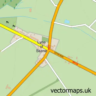
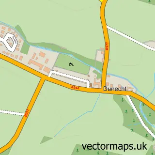
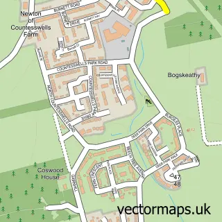
This Kirkton of Skene street map is a detailed vector street map covering a 750m x 750m area. Select a larger area to create and download your own vector street map of Kirkton of Skene.
The 750-metre map sample for Kirkton of Skene covers 113 mapped buildings and approximately 8.6 km of road detail, of which 7 named roads are named. The immediate area includes 1 pub and 2 MOT stations within 2 miles. The wider area around Kirkton of Skene features 2 food and drink venues. To create a larger or custom map of Kirkton of Skene, the map builder lets you define your own coverage area and download editable SVG, PDF and PNG files.
Create a larger editable map of Kirkton of Skene
Choose any area you need and generate a high-quality vector map instantly. Perfect for print, planning, design, business and personal use.

This Kirkton of Skene street map in Aberdeenshire is available as downloadable SVG, PDF and PNG map files, or as a printed map for planning, business, display, education, local information and design work. You can also create a larger custom map area using the map selector.
What this Kirkton of Skene map sample shows
Kirkton of Skene lies within Aberdeenshire parish, part of Westhill And District ward in the Aberdeenshire local authority area. The postcode geography for this area includes the AB postcode area, the AB32 postcode district and the AB32 6 postcode sector. Residents fall under the Grampian for NHS services.
Local features near Kirkton of Skene
Within 2 milesAmenities and services in and around Kirkton of Skene.
Administrative and postcode information for Kirkton of Skene
Kirkton of Skene lies within Aberdeenshire parish, part of Westhill And District ward in the Aberdeenshire local authority area. The postcode geography for this area includes the AB postcode area, the AB32 postcode district and the AB32 6 postcode sector. Residents fall under the Grampian for NHS services.
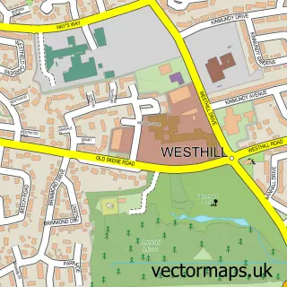
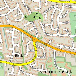
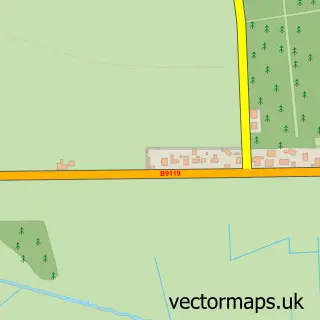
Nearby street map samples around Kirkton of Skene

More street maps in Aberdeenshire
750 metre map area coverage
Boundary, postcode and point of interest information for the 750m x 750m rectangle centred on this sample map.
Boundaries containing map centre
Constituency: West Aberdeenshire and Kincardine Co Const
District: Aberdeenshire
Icb: Grampian
Postcode District: AB32
Postcode Sector: AB32 6
Ward: Westhill and District Ward
Nearby boundaries intersecting sample
No additional intersecting boundaries found.
Postcode coverage
POI category counts
Bar: 1
Cafe: 1
Catholic Church: 1
Chinese Restaurant: 1
Church Cathedral: 1
Community Center: 1
Corporate Office: 1
Fish And Chips Restaurant: 1
Holiday Rental Home: 1
Italian Restaurant: 1
Sample points of interest
- Red Star Inn
- Bothy 57
- Skene
- Star Light Chinese takeaway
- Skene Parish Church
- Milne Hall
- Oilex Ltd.
- Hosie's Fish and Chips
- Kirkton House
- Da Giorgio Trattoria
- The Village Store
- Park Lodge Care Home - Sanctuary Care
Create a larger editable map of Kirkton of Skene
This sample shows only a 750 metre area. To create a larger map of Kirkton of Skene, use our map builder to choose your own coverage area, add titles and download editable SVG, PDF and PNG files.
Create a custom map of Kirkton of Skene