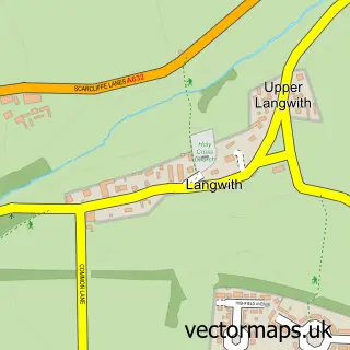
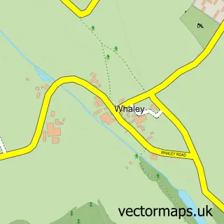
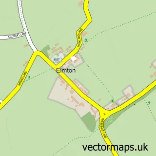
This Langwith street map is a detailed vector street map covering a 750m x 750m area. Select a larger area to create and download your own vector street map of Langwith.
The 750-metre map sample for Langwith covers 198 mapped buildings and approximately 18.0 km of road detail, of which 10 named roads are named. The immediate area includes 1 GP surgery within 2 miles and 5 MOT stations within 2 miles. To create a larger or custom map of Langwith, the map builder lets you define your own coverage area and download editable SVG, PDF and PNG files.
Create a larger editable map of Langwith
Choose any area you need and generate a high-quality vector map instantly. Perfect for print, planning, design, business and personal use.

This Langwith street map in Derbyshire is available as downloadable SVG, PDF and PNG map files, or as a printed map for planning, business, display, education, local information and design work. You can also create a larger custom map area using the map selector.
What this Langwith map sample shows
Langwith lies within Langwith Cp parish, part of Langwith ward in the Bolsover District local authority area. The postcode geography for this area includes the NG postcode area, the NG20 postcode district and the NG20 9 postcode sector. Residents fall under the Nhs Derby And Derbyshire Integrated Care Board for NHS services.
Local features near Langwith
Within 2 milesAmenities and services in and around Langwith.
Administrative and postcode information for Langwith
Langwith lies within Langwith Cp parish, part of Langwith ward in the Bolsover District local authority area. The postcode geography for this area includes the NG postcode area, the NG20 postcode district and the NG20 9 postcode sector. Residents fall under the Nhs Derby And Derbyshire Integrated Care Board for NHS services.
Nearby street map samples around Langwith

More street maps in Derbyshire
750 metre map area coverage
Boundary, postcode and point of interest information for the 750m x 750m rectangle centred on this sample map.
Boundaries containing map centre
Constituency: Bolsover Co Const
County: Derbyshire County
District: Bolsover District
Icb: NHS Derby and Derbyshire ICB
Parish: Langwith CP
Police Force: derbyshire
Postcode District: NG20
Postcode Sector: NG20 9
Ward: Langwith Ward
Nearby boundaries intersecting sample
County: Nottinghamshire County
Postcode coverage
POI category counts
Contractor: 2
Beauty And Spa: 1
Business Manufacturing And Supply: 1
Caterer: 1
Childrens Clothing Store: 1
Driving School: 1
Gardener: 1
Horseback Riding Service: 1
Land Surveying: 1
Post Office: 1
Sample points of interest
- Maria Swedish Massage Salon
- Hose & Hydraulic Services
- Shop-Equip
- First Years Boutique
- Danby Painting Contractors
- Pete's Joinery
- AA Instructor Joanne Machin
- Acorn Gardening Services
- Derbyshire Pony Trekking
- Playle & Partners
- Prodrive Training Solutions
- Direct P A Services
Create a larger editable map of Langwith
This sample shows only a 750 metre area. To create a larger map of Langwith, use our map builder to choose your own coverage area, add titles and download editable SVG, PDF and PNG files.
Create a custom map of Langwith