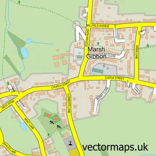
This Launton street map is a detailed vector street map covering a 750m x 750m area. Select a larger area to create and download your own vector street map of Launton.
The 750-metre map sample for Launton covers 400 mapped buildings and approximately 19.3 km of road detail, of which 16 named roads are named. The immediate area includes 1 school, 3 GP surgeries within 2 miles, 2 pubs and 11 MOT stations within 2 miles. The wider area around Launton features 3 food and drink venues. To create a larger or custom map of Launton, the map builder lets you define your own coverage area and download editable SVG, PDF and PNG files.
Create a larger editable map of Launton
Choose any area you need and generate a high-quality vector map instantly. Perfect for print, planning, design, business and personal use.

This Launton street map in Oxfordshire is available as downloadable SVG, PDF and PNG map files, or as a printed map for planning, business, display, education, local information and design work. You can also create a larger custom map area using the map selector.
What this Launton map sample shows
Launton lies within Launton Cp parish, part of Launton And Otmoor ward in the Cherwell District local authority area. The postcode geography for this area includes the OX postcode area, the OX26 postcode district and the OX26 5 postcode sector. Residents fall under the Nhs Buckinghamshire, Oxfordshire And Berkshire West Integrated Care Board for NHS services.
Local features near Launton
Within 2 milesAmenities and services in and around Launton.
Administrative and postcode information for Launton
Launton lies within Launton Cp parish, part of Launton And Otmoor ward in the Cherwell District local authority area. The postcode geography for this area includes the OX postcode area, the OX26 postcode district and the OX26 5 postcode sector. Residents fall under the Nhs Buckinghamshire, Oxfordshire And Berkshire West Integrated Care Board for NHS services.
Nearby street map samples around Launton


More street maps in Oxfordshire
750 metre map area coverage
Boundary, postcode and point of interest information for the 750m x 750m rectangle centred on this sample map.
Boundaries containing map centre
Constituency: Bicester and Woodstock Co Const
County: Oxfordshire County
District: Cherwell District
Icb: NHS Thames Valley ICB
Parish: Launton CP
Police Force: thames valley
Postcode District: OX26
Postcode Sector: OX26 5
Ward: Launton & Otmoor Ward
Nearby boundaries intersecting sample
No additional intersecting boundaries found.
Postcode coverage
POI category counts
Building Supply Store: 4
Professional Services: 3
Books Mags Music And Video: 2
Convenience Store: 2
Electrician: 2
Elementary School: 2
Hair Salon: 2
Home Goods Store: 2
Preschool: 2
Pub: 2
Sample points of interest
- Peace of Mind Hypnotherapy
- Launton Post Office
- Post Office-Launton
- Atmosphere Electrical
- Jewson
- Jewson
- Wolseley Climate Centre
- The Blue Texel
- The Hat Hire Co.
- Costa Express
- Launton Parish Hall
- JC Drives and Patios
Create a larger editable map of Launton
This sample shows only a 750 metre area. To create a larger map of Launton, use our map builder to choose your own coverage area, add titles and download editable SVG, PDF and PNG files.
Create a custom map of Launton