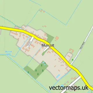
This Ambrosden street map is a detailed vector street map covering a 750m x 750m area. Select a larger area to create and download your own vector street map of Ambrosden.
The 750-metre map sample for Ambrosden covers 287 mapped buildings and approximately 31.9 km of road detail, of which 29 named roads are named. The immediate area includes 1 school, 1 GP surgery within 2 miles, 1 pub and 1 MOT station, with 2 within 2 miles. The wider area around Ambrosden features 1 tourism point of interest and 1 food and drink venue. To create a larger or custom map of Ambrosden, the map builder lets you define your own coverage area and download editable SVG, PDF and PNG files.
Create a larger editable map of Ambrosden
Choose any area you need and generate a high-quality vector map instantly. Perfect for print, planning, design, business and personal use.

This Ambrosden street map in Oxfordshire is available as downloadable SVG, PDF and PNG map files, or as a printed map for planning, business, display, education, local information and design work. You can also create a larger custom map area using the map selector.
What this Ambrosden map sample shows
Ambrosden lies within Ambrosden Cp parish, part of Bicester South And Ambrosden ward in the Cherwell District local authority area. The postcode geography for this area includes the OX postcode area, the OX25 postcode district and the OX25 2 postcode sector. Residents fall under the Nhs Buckinghamshire, Oxfordshire And Berkshire West Integrated Care Board for NHS services.
Local features near Ambrosden
Within 2 milesAmenities and services in and around Ambrosden.
Administrative and postcode information for Ambrosden
The local authority covering Ambrosden is Cherwell District, within the county of Oxfordshire. The settlement lies within Bicester South And Ambrosden ward and Ambrosden Cp civil parish. The OX25 postcode district and OX25 2 postcode sector serve the immediate area. NHS provision in the area is delivered through Oxford University Hospitals Nhs Foundation Trust.
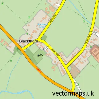
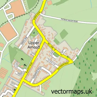
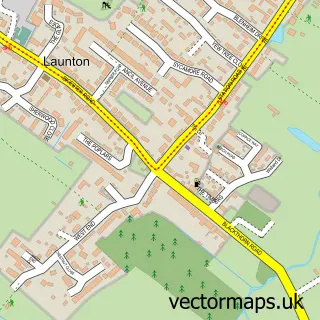
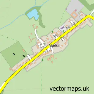
Nearby street map samples around Ambrosden


More street maps in Oxfordshire
750 metre map area coverage
Boundary, postcode and point of interest information for the 750m x 750m rectangle centred on this sample map.
Boundaries containing map centre
Constituency: Bicester and Woodstock Co Const
County: Oxfordshire County
District: Cherwell District
Icb: NHS Thames Valley ICB
Parish: Ambrosden CP
Police Force: thames valley
Postcode District: OX25
Postcode Sector: OX25 2
Ward: Bicester South & Ambrosden Ward
Nearby boundaries intersecting sample
No additional intersecting boundaries found.
Postcode coverage
POI category counts
Beauty Salon: 3
Building Supply Store: 2
Flowers And Gifts Shop: 2
Hair Salon: 2
Kitchen Remodeling: 2
Shipping Center: 2
Active Life: 1
Anglican Church: 1
Armed Forces Branch: 1
Art Gallery: 1
Sample points of interest
- Aqua Splash Swimming Academy
- St Mary the Virgin, Ambrosden
- Ambrosden (HQ)
- Mark Goodson - Artist
- Attitude Autos
- Three Corners Garage
- All things beauty by Katie
- Beautiful Treats
- Mary Louise Beauty and Aesthetics
- Acorn Property Services & Maintenance Ltd
- Simpson's Heating Engineers
- Ambrosden Village Hall
Create a larger editable map of Ambrosden
This sample shows only a 750 metre area. To create a larger map of Ambrosden, use our map builder to choose your own coverage area, add titles and download editable SVG, PDF and PNG files.
Create a custom map of Ambrosden