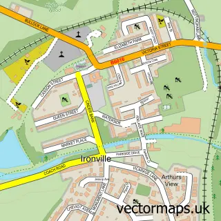
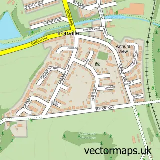
This Leabrooks street map is a detailed vector street map covering a 750m x 750m area. Select a larger area to create and download your own vector street map of Leabrooks.
The 750-metre map sample for Leabrooks covers 403 mapped buildings and approximately 19.1 km of road detail, of which 29 named roads are named. The immediate area includes 1 GP surgery, with 4 within 2 miles, 1 pub and 1 MOT station, with 15 within 2 miles. The wider area around Leabrooks features 1 tourism point of interest, 3 food and drink venues and 2 campsites within 2 miles. To create a larger or custom map of Leabrooks, the map builder lets you define your own coverage area and download editable SVG, PDF and PNG files.
Create a larger editable map of Leabrooks
Choose any area you need and generate a high-quality vector map instantly. Perfect for print, planning, design, business and personal use.

This Leabrooks street map in Derbyshire is available as downloadable SVG, PDF and PNG map files, or as a printed map for planning, business, display, education, local information and design work. You can also create a larger custom map area using the map selector.
What this Leabrooks map sample shows
Leabrooks lies within Somercotes Cp parish, part of Somercotes ward in the Amber Valley District (B) local authority area. The postcode geography for this area includes the DE postcode area, the DE55 postcode district and the DE55 4 postcode sector. Residents fall under the Nhs Derby And Derbyshire Integrated Care Board for NHS services.
Local features near Leabrooks
Within 2 milesAmenities and services in and around Leabrooks.
Administrative and postcode information for Leabrooks
Leabrooks lies within Somercotes Cp parish, part of Somercotes ward in the Amber Valley District (B) local authority area. The postcode geography for this area includes the DE postcode area, the DE55 postcode district and the DE55 4 postcode sector. Residents fall under the Nhs Derby And Derbyshire Integrated Care Board for NHS services.
Nearby street map samples around Leabrooks


More street maps in Derbyshire
750 metre map area coverage
Boundary, postcode and point of interest information for the 750m x 750m rectangle centred on this sample map.
Boundaries containing map centre
Constituency: Amber Valley Co Const
County: Derbyshire County
District: Amber Valley District (B)
Icb: NHS Derby and Derbyshire ICB
Parish: Somercotes CP
Police Force: derbyshire
Postcode District: DE55
Postcode Sector: DE55 1
Ward: Somercotes Ward
Nearby boundaries intersecting sample
Parish: Swanwick CP
Postcode Sector: DE55 4
Ward: Ironville & Riddings Ward, Swanwick Ward
Postcode coverage
POI category counts
Bakery: 4
Beauty Salon: 3
Doctor: 3
Automotive Repair: 2
Church Cathedral: 2
Clothing Store: 2
Hair Salon: 2
Pharmacy: 2
Public Service And Government: 2
Used Car Dealer: 2
Sample points of interest
- Leabrooks Arts Complex
- Central England Co-Op - Leabrooks 2nd Store (ERF), Leabrook
- Ram Gate Automation Limited
- Custom Cruisers
- D & D Vehicle Services
- Beach's Bakery
- Cakey Bakey Art (Sugarcraft School)
- Eat Your Photo
- W Beach & Son
- Bathroom Images
- Velvet doll lashes ellé
- LUX Beauty And Tanning Ltd.
Create a larger editable map of Leabrooks
This sample shows only a 750 metre area. To create a larger map of Leabrooks, use our map builder to choose your own coverage area, add titles and download editable SVG, PDF and PNG files.
Create a custom map of Leabrooks