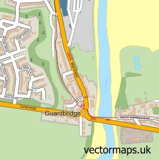
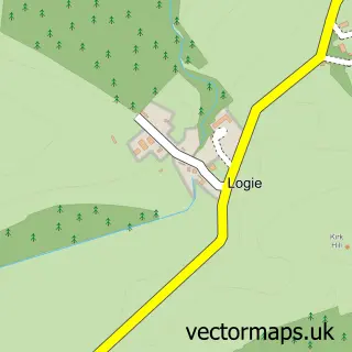
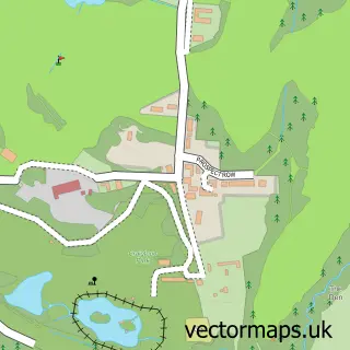
This Leuchars street map is a detailed vector street map covering a 750m x 750m area. Select a larger area to create and download your own vector street map of Leuchars.
The 750-metre map sample for Leuchars covers 126 mapped buildings and approximately 19.2 km of road detail, of which 34 named roads are named. The immediate area includes 1 GP surgery within 2 miles, 2 pubs and 1 MOT station within 2 miles. The wider area around Leuchars features 6 food and drink venues and 2 hotels. To create a larger or custom map of Leuchars, the map builder lets you define your own coverage area and download editable SVG, PDF and PNG files.
Create a larger editable map of Leuchars
Choose any area you need and generate a high-quality vector map instantly. Perfect for print, planning, design, business and personal use.

This Leuchars street map in Fife is available as downloadable SVG, PDF and PNG map files, or as a printed map for planning, business, display, education, local information and design work. You can also create a larger custom map area using the map selector.
What this Leuchars map sample shows
Leuchars lies within Fife parish, part of Tay Bridgehead ward in the Fife local authority area. The postcode geography for this area includes the KY postcode area, the KY16 postcode district and the KY16 0 postcode sector. Residents fall under the Fife for NHS services.
Local features near Leuchars
Within 2 milesAmenities and services in and around Leuchars.
Administrative and postcode information for Leuchars
Leuchars lies within Fife parish, part of Tay Bridgehead ward in the Fife local authority area. The postcode geography for this area includes the KY postcode area, the KY16 postcode district and the KY16 0 postcode sector. Residents fall under the Fife for NHS services.
Nearby street map samples around Leuchars

More street maps in Fife
750 metre map area coverage
Boundary, postcode and point of interest information for the 750m x 750m rectangle centred on this sample map.
Boundaries containing map centre
Constituency: North East Fife Co Const
District: Fife
Icb: Fife
Postcode District: KY16
Postcode Sector: KY16 0
Ward: Tay Bridgehead Ward
Nearby boundaries intersecting sample
No additional intersecting boundaries found.
Postcode coverage
POI category counts
Cafe: 3
Beauty Salon: 2
Bicycle Shop: 2
Books Mags Music And Video: 2
Church Cathedral: 2
Community Center: 2
Convenience Store: 2
Doctor: 2
Hair Salon: 2
Hotel: 2
Sample points of interest
- RAF Leuchars, Scotland
- Leuchars Station, Leuchars
- The Detailing Co
- Every Little Detail
- Maryposa Nails
- Michelle Kirk Beauty & Nails
- Fife Cycle Centre
- PJ e-Bike Hire
- Leuchars Post Office
- Post Office-Leuchars
- John Stevens Roofing
- Leuchars Butchers
Create a larger editable map of Leuchars
This sample shows only a 750 metre area. To create a larger map of Leuchars, use our map builder to choose your own coverage area, add titles and download editable SVG, PDF and PNG files.
Create a custom map of Leuchars