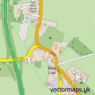
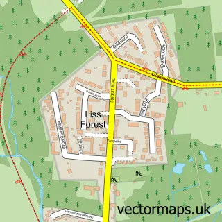
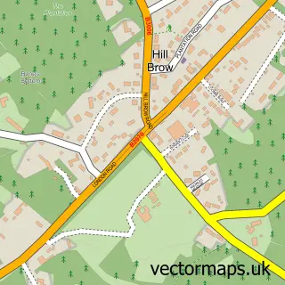
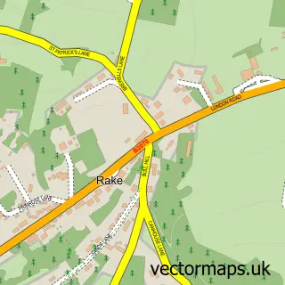
This Liss street map is a detailed vector street map covering a 750m x 750m area. Select a larger area to create and download your own vector street map of Liss.
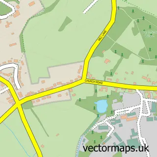
The 750-metre map sample for Liss covers 467 mapped buildings and approximately 14.2 km of road detail, of which 34 named roads are named. The immediate area includes 1 railway station, 1 pub and 1 MOT station, with 4 within 2 miles. The wider area around Liss features 1 tourism point of interest and 5 food and drink venues. To create a larger or custom map of Liss, the map builder lets you define your own coverage area and download editable SVG, PDF and PNG files.
Create a larger editable map of Liss
Choose any area you need and generate a high-quality vector map instantly. Perfect for print, planning, design, business and personal use.

This Liss street map in Hampshire is available as downloadable SVG, PDF and PNG map files, or as a printed map for planning, business, display, education, local information and design work. You can also create a larger custom map area using the map selector.
What this Liss map sample shows
Liss lies within Liss Cp parish, part of Liss ward in the East Hampshire District local authority area. The postcode geography for this area includes the GU postcode area, the GU33 postcode district and the GU33 7 postcode sector. Residents fall under the Nhs Hampshire And Isle Of Wight Integrated Care Board for NHS services.
Local features near Liss
Within 2 milesAmenities and services in and around Liss.
Administrative and postcode information for Liss
The local authority covering Liss is East Hampshire District, within the county of Hampshire. The settlement lies within Liss ward and Liss Cp civil parish. The GU33 postcode district and GU33 7 postcode sector serve the immediate area. NHS provision in the area is delivered through Portsmouth Hospitals University National Health Service Trust.
Nearby street map samples around Liss

More street maps in Hampshire
750 metre map area coverage
Boundary, postcode and point of interest information for the 750m x 750m rectangle centred on this sample map.
Boundaries containing map centre
Constituency: East Hampshire Co Const
County: Hampshire County
District: East Hampshire District
Icb: NHS Hampshire and Isle of Wight ICB
Parish: Liss CP
Police Force: hampshire
Postcode District: GU33
Postcode Sector: GU33 7
Ward: Liss Ward
Nearby boundaries intersecting sample
No additional intersecting boundaries found.
Postcode coverage
POI category counts
Flowers And Gifts Shop: 4
Advertising Agency: 3
Beauty Salon: 3
Indian Restaurant: 3
Professional Services: 3
Building Supply Store: 2
Business Consulting: 2
Church Cathedral: 2
Coffee Shop: 2
Community Center: 2
Sample points of interest
- A G Creative Space
- Alpha Graphics
- Compege
- Sue Ryder Care
- Gosden Guitars
- Liss Garage Services
- Bake O Cake
- 10 Station Road
- Legends barber
- 1984's Beauty & Bar Limited
- Em'body Beauty
- Inner Health
Create a larger editable map of Liss
This sample shows only a 750 metre area. To create a larger map of Liss, use our map builder to choose your own coverage area, add titles and download editable SVG, PDF and PNG files.
Create a custom map of Liss