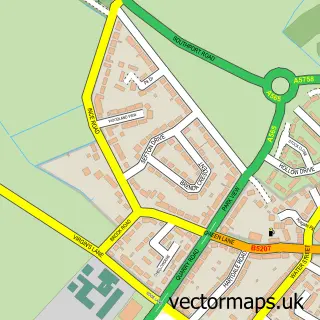
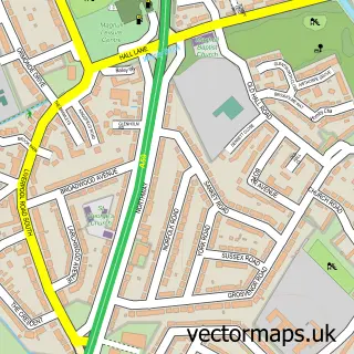
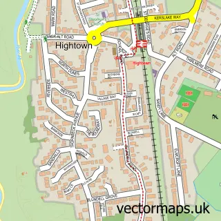
This Litherland street map is a detailed vector street map covering a 750m x 750m area. Select a larger area to create and download your own vector street map of Litherland.
The 750-metre map sample for Litherland covers 529 mapped buildings and approximately 23.1 km of road detail, of which 43 named roads are named. The immediate area includes 2 schools, 1 GP surgery, with 23 within 2 miles, 1 pub and 40 MOT stations within 2 miles. The wider area around Litherland features 2 food and drink venues. To create a larger or custom map of Litherland, the map builder lets you define your own coverage area and download editable SVG, PDF and PNG files.
Create a larger editable map of Litherland
Choose any area you need and generate a high-quality vector map instantly. Perfect for print, planning, design, business and personal use.

This Litherland street map in Merseyside is available as downloadable SVG, PDF and PNG map files, or as a printed map for planning, business, display, education, local information and design work. You can also create a larger custom map area using the map selector.
What this Litherland map sample shows
Litherland lies within Sefton District (B) parish, part of Ford ward in the Sefton District (B) local authority area. The postcode geography for this area includes the L postcode area, the L21 postcode district and the L21 9 postcode sector. Residents fall under the Nhs Cheshire And Merseyside Integrated Care Board for NHS services.
Local features near Litherland
Within 2 milesAmenities and services in and around Litherland.
Administrative and postcode information for Litherland
The local authority covering Litherland is Sefton District (B), within the county of Merseyside. The settlement lies within Ford ward and Sefton District (B) civil parish. The L21 postcode district and L21 9 postcode sector serve the immediate area. NHS provision in the area is delivered through Liverpool University Hospitals Nhs Foundation Trust.
Nearby street map samples around Litherland

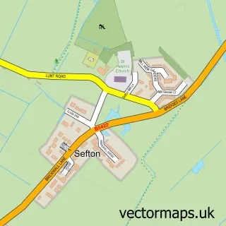
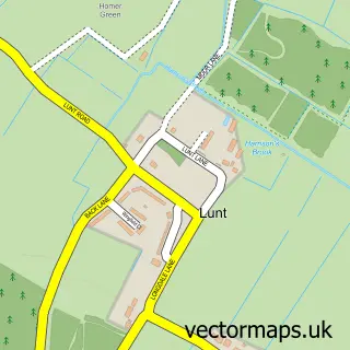
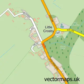
More street maps in Merseyside
750 metre map area coverage
Boundary, postcode and point of interest information for the 750m x 750m rectangle centred on this sample map.
Boundaries containing map centre
Constituency: Bootle Boro Const
District: Sefton District (B)
Icb: NHS Lancashire and South Cumbria ICB
Police Force: merseyside
Postcode District: L21
Postcode Sector: L21 7
Ward: Ford Ward
Nearby boundaries intersecting sample
Postcode District: L20
Postcode Sector: L20 6, L21 2, L21 5, L21 6, L21 8, L21 9
Ward: Litherland Ward
Postcode coverage
POI category counts
Hair Salon: 4
Building Supply Store: 3
Doctor: 3
Automotive Repair: 2
Bar: 2
Barber: 2
Child Care And Day Care: 2
Church Cathedral: 2
Convenience Store: 2
Day Care Preschool: 2
Sample points of interest
- Alternative Futures Group
- Litherland
- Ossetsound Mot Centre
- Seafort Taxis Repairs
- NatWest
- Aminata Bar & bistro
- L21 Club Official
- Piccola Bar and Kitchen
- Barber King Litherland
- The Traditional Barber Shop
- Number Thirty One
- William Hill
Create a larger editable map of Litherland
This sample shows only a 750 metre area. To create a larger map of Litherland, use our map builder to choose your own coverage area, add titles and download editable SVG, PDF and PNG files.
Create a custom map of Litherland