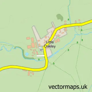
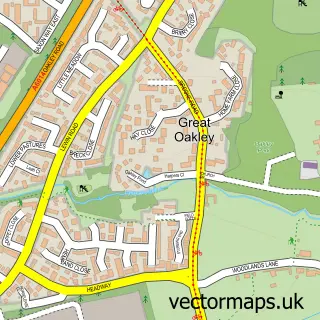
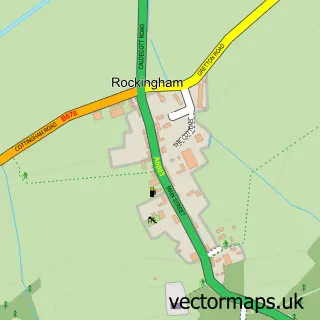
This Little Stanion street map is a detailed vector street map covering a 750m x 750m area. Select a larger area to create and download your own vector street map of Little Stanion.
The 750-metre map sample for Little Stanion covers 324 mapped buildings and approximately 29.6 km of road detail, of which 16 named roads are named. The immediate area includes 1 school, 3 GP surgeries within 2 miles and 14 MOT stations within 2 miles. To create a larger or custom map of Little Stanion, the map builder lets you define your own coverage area and download editable SVG, PDF and PNG files.
Create a larger editable map of Little Stanion
Choose any area you need and generate a high-quality vector map instantly. Perfect for print, planning, design, business and personal use.

This Little Stanion street map in Northamptonshire is available as downloadable SVG, PDF and PNG map files, or as a printed map for planning, business, display, education, local information and design work. You can also create a larger custom map area using the map selector.
What this Little Stanion map sample shows
Little Stanion lies within Stanion Cp parish, part of Stanion & Corby Village ward in the North Northamptonshire local authority area. The postcode geography for this area includes the NN postcode area, the NN14 postcode district and the NN14 1 postcode sector. Residents fall under the Nhs Northamptonshire Integrated Care Board for NHS services.
Local features near Little Stanion
Within 2 milesAmenities and services in and around Little Stanion.
Administrative and postcode information for Little Stanion
Little Stanion lies within Stanion Cp parish, part of Stanion & Corby Village ward in the North Northamptonshire local authority area. The postcode geography for this area includes the NN postcode area, the NN14 postcode district and the NN14 1 postcode sector. Residents fall under the Nhs Northamptonshire Integrated Care Board for NHS services.
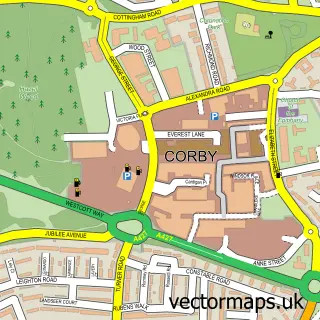
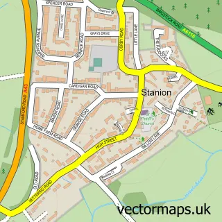
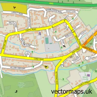
Nearby street map samples around Little Stanion

More street maps in Northamptonshire
750 metre map area coverage
Boundary, postcode and point of interest information for the 750m x 750m rectangle centred on this sample map.
Boundaries containing map centre
Constituency: Kettering Co Const
District: North Northamptonshire
Icb: NHS Northamptonshire ICB
Parish: Little Stanion CP
Police Force: northamptonshire
Postcode District: NN18
Postcode Sector: NN18 8
Ward: Geddington & Stanion Ward
Nearby boundaries intersecting sample
Constituency: Corby and East Northamptonshire Co Const
Parish: Corby CP, Newton and Little Oakley CP, Stanion CP
Postcode District: NN14
Postcode Sector: NN14 1
Ward: Lloyds & Corby Village Ward
Postcode coverage
POI category counts
Beauty Salon: 3
Driving School: 3
Marketing Agency: 2
Auto Detailing: 1
Business: 1
Day Care Preschool: 1
Education: 1
Electrician: 1
Elementary School: 1
Fence And Gate Sales Service: 1
Sample points of interest
- Xperior Detailing
- Aesthetic Skin Clinic and Academy
- Confidence- beauty consultant
- Jamie Rose Hairdressing
- Agency Care Staff Ltd.
- Rebecca Mitchell Childcare - Little Stanion
- Alex's Driving School
- Learn Driver Training
- Sam Foster Driving School
- Acstra Training
- T.N Electrical
- Little Stanion Primary School
Create a larger editable map of Little Stanion
This sample shows only a 750 metre area. To create a larger map of Little Stanion, use our map builder to choose your own coverage area, add titles and download editable SVG, PDF and PNG files.
Create a custom map of Little Stanion