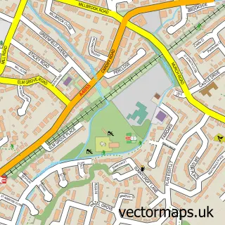
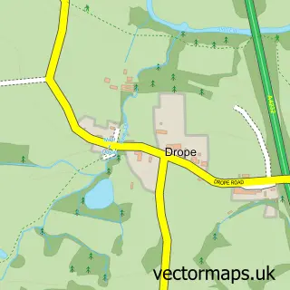
This Llandough street map is a detailed vector street map covering a 750m x 750m area. Select a larger area to create and download your own vector street map of Llandough.
The 750-metre map sample for Llandough covers 333 mapped buildings and approximately 17.2 km of road detail, of which 32 named roads are named. The immediate area includes 1 school, 1 GP surgery within 2 miles, 1 pub and 28 MOT stations within 2 miles. The wider area around Llandough features 1 food and drink venue and 1 hotel. To create a larger or custom map of Llandough, the map builder lets you define your own coverage area and download editable SVG, PDF and PNG files.
Create a larger editable map of Llandough
Choose any area you need and generate a high-quality vector map instantly. Perfect for print, planning, design, business and personal use.

This Llandough street map in South Glamorgan is available as downloadable SVG, PDF and PNG map files, or as a printed map for planning, business, display, education, local information and design work. You can also create a larger custom map area using the map selector.
What this Llandough map sample shows
Llandough lies within Llandough Community parish, part of Llandough ward in the Bro Morgannwg - The Vale Of Glamorgan local authority area. The postcode geography for this area includes the CF postcode area, the CF64 postcode district and the CF64 2 postcode sector. Residents fall under the Cardiff And Vale University Health Board for NHS services.
Local features near Llandough
Within 2 milesAmenities and services in and around Llandough.
Administrative and postcode information for Llandough
The local authority covering Llandough is Bro Morgannwg - The Vale Of Glamorgan, within the county of South Glamorgan. The settlement lies within Llandough ward and Llandough Community civil parish. The CF64 postcode district and CF64 2 postcode sector serve the immediate area. NHS provision in the area is delivered through Cardiff And Vale University Health Board.
Nearby street map samples around Llandough


More street maps in South Glamorgan

750 metre map area coverage
Boundary, postcode and point of interest information for the 750m x 750m rectangle centred on this sample map.
Boundaries containing map centre
Constituency: Cardiff South and Penarth Boro Const
District: Bro Morgannwg - the Vale of Glamorgan
Icb: Cardiff and Vale University
Parish: Llandough Community
Police Force: south wales
Postcode District: CF64
Postcode Sector: CF64 2
Nearby boundaries intersecting sample
Parish: Dinas Powys Community, Penarth Community
Postcode District: CF11
Postcode Sector: CF11 0, CF11 8, CF64 4
Postcode coverage
POI category counts
Doctor: 2
Hospital: 2
Advertising Agency: 1
Baby Gear And Furniture: 1
Beauty And Spa: 1
Car Dealer: 1
Charity Organization: 1
Cupcake Shop: 1
Elementary School: 1
Home Security: 1
Sample points of interest
- Dai Lingual
- Cots Of Distinction
- RR Beauty
- Better Performance
- The Forget Me Not Chorus
- Fairy Cake Counter
- Laserase Wales Within Llandough Hospital
- University Hospital Llandough - Car Park 11
- Llandough Primary School
- Future CCTV
- Antenatal Clinic
- Cardiology Llandough Hospi
Create a larger editable map of Llandough
This sample shows only a 750 metre area. To create a larger map of Llandough, use our map builder to choose your own coverage area, add titles and download editable SVG, PDF and PNG files.
Create a custom map of Llandough