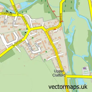
This Longstock street map is a detailed vector street map covering a 750m x 750m area. Select a larger area to create and download your own vector street map of Longstock.
The 750-metre map sample for Longstock covers 98 mapped buildings and approximately 5.1 km of road detail, of which 1 named road are named. The immediate area includes 1 GP surgery within 2 miles and 2 pubs. The wider area around Longstock features 1 tourism point of interest and 2 food and drink venues. To create a larger or custom map of Longstock, the map builder lets you define your own coverage area and download editable SVG, PDF and PNG files.
Create a larger editable map of Longstock
Choose any area you need and generate a high-quality vector map instantly. Perfect for print, planning, design, business and personal use.

This Longstock street map in Hampshire is available as downloadable SVG, PDF and PNG map files, or as a printed map for planning, business, display, education, local information and design work. You can also create a larger custom map area using the map selector.
What this Longstock map sample shows
Longstock lies within Longstock Cp parish, part of Mid Test ward in the Test Valley District local authority area. The postcode geography for this area includes the SO postcode area, the SO20 postcode district and the SO20 6 postcode sector. Residents fall under the Nhs Hampshire And Isle Of Wight Integrated Care Board for NHS services.
Local features near Longstock
Within 2 milesAmenities and services in and around Longstock.
Administrative and postcode information for Longstock
Longstock lies within Longstock Cp parish, part of Mid Test ward in the Test Valley District local authority area. The postcode geography for this area includes the SO postcode area, the SO20 postcode district and the SO20 6 postcode sector. Residents fall under the Nhs Hampshire And Isle Of Wight Integrated Care Board for NHS services.
Nearby street map samples around Longstock

More street maps in Hampshire
750 metre map area coverage
Boundary, postcode and point of interest information for the 750m x 750m rectangle centred on this sample map.
Boundaries containing map centre
Constituency: Romsey and Southampton North Co Const
County: Hampshire County
District: Test Valley District
Icb: NHS Hampshire and Isle of Wight ICB
Parish: Longstock CP
Police Force: hampshire
Postcode District: SO20
Postcode Sector: SO20 6
Ward: Mid Test Ward
Nearby boundaries intersecting sample
Parish: Leckford CP
Postcode coverage
POI category counts
Pub: 2
Anglican Church: 1
Art Gallery: 1
Community Center: 1
Park: 1
Plastic Fabrication Company: 1
Sample points of interest
- St Mary
- Eastwood Fine Art
- Longstock Village Hall
- Longstock Recreation Ground
- The R & D Factory
- Peat Spade Pub and Dining
- The Peat Spade Inn
Create a larger editable map of Longstock
This sample shows only a 750 metre area. To create a larger map of Longstock, use our map builder to choose your own coverage area, add titles and download editable SVG, PDF and PNG files.
Create a custom map of Longstock