Vector Maps logo
Home Why it works Popular maps Districts Samples Customizer Create Your Map
VectorMaps.uk
Home Popular maps Districts Samples Customizer Create Your Map Privacy Disclaimer
Home / UK Maps / Somerset / Lopen Map

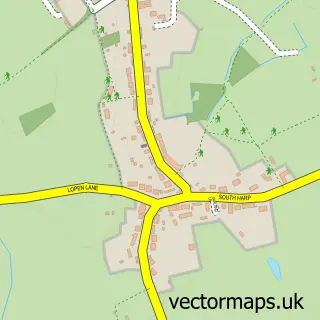
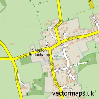
This Lopen street map is a detailed vector street map covering a 750m x 750m area. Select a larger area to create and download your own vector street map of Lopen.

Lopen is a village in Somerset, in the South West of England. The settlement falls within the Yeovil parliamentary constituency. It is served by the TA13 postcode district, with TA13 5 as the local postcode sector.

The 750-metre map sample for Lopen covers 133 mapped buildings and approximately 5.8 km of road detail, of which 9 named roads are named. The immediate area includes 1 MOT station within 2 miles. To create a larger or custom map of Lopen, the map builder lets you define your own coverage area and download editable SVG, PDF and PNG files.

133Buildings
5.83 kmRoads
9Named roads
3,137Residents within 2 miles
Create your own

Create a larger editable map of Lopen

Choose any area you need and generate a high-quality vector map instantly. Perfect for print, planning, design, business and personal use.

Choose any location
Editable SVG files
Any size up to A0
PDF, PNG & more
Instant download
High quality guaranteed
Create My Custom Map
Secure, private & no credit card required
Lopen Vector Street Map
750m Sample
Lopen vector street map sample showing roads, buildings and local features in a 750 metre preview area
Buy Lopen Map Print from £12.95 Buy Lopen Digital Map from £6

This Lopen street map in Somerset is available as downloadable SVG, PDF and PNG map files, or as a printed map for planning, business, display, education, local information and design work. You can also create a larger custom map area using the map selector.

What this Lopen map sample shows

Lopen lies within Lopen Cp parish, part of South Petherton ward in the Somerset local authority area. The postcode geography for this area includes the TA postcode area, the TA13 postcode district and the TA13 5 postcode sector. Residents fall under the Nhs Somerset Integrated Care Board for NHS services.

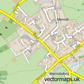
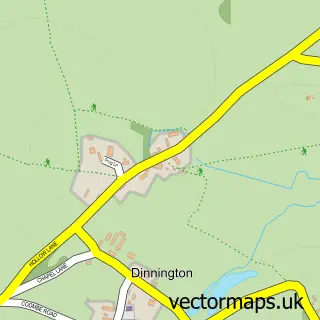
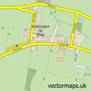
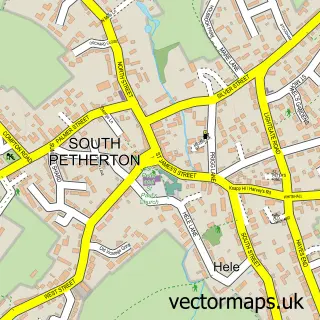
Local features near Lopen

Within 2 miles

Amenities and services in and around Lopen.

1 MOT stations within 2 miles

Counts are approximate and based on publicly available data.

Administrative and postcode information for Lopen

The local authority covering Lopen is Somerset, within the county of Somerset. The settlement lies within South Petherton ward and Lopen Cp civil parish. The TA13 postcode district and TA13 5 postcode sector serve the immediate area. NHS provision in the area is delivered through Yeovil District Hospital Nhs Foundation Trust.

Parish Lopen CP
Ward South Petherton
District / local authority Somerset
County Somerset
Historic county Somerset
Postcode district TA13
Postcode sector TA13 5
Parliamentary constituency Yeovil
Region South West
Country England

Nearby street map samples around Lopen

Street map sample of Crewkerne, Somerset Crewkerne Town - Somerset - 3.0 miles Street map sample of Wells, Somerset Wells City - Somerset - 21.0 miles Street map sample of Over Stratton, Somerset Over Stratton Village - Somerset - 0.8 miles Street map sample of Hinton St George, Somerset Hinton St George Village - Somerset - 1.1 miles Street map sample of Seavington St Michael, Somerset Seavington St Michael Village - Somerset - 1.2 miles Street map sample of Merriott, Somerset Merriott Village - Somerset - 1.6 miles Street map sample of Dinnington, Somerset Dinnington Village - Somerset - 1.6 miles Street map sample of Seavington St Mary, Somerset Seavington St Mary Village - Somerset - 1.6 miles Street map sample of South Petherton, Somerset South Petherton Village - Somerset - 1.6 miles Street map sample of Shepton Beauchamp, Somerset Shepton Beauchamp Village - Somerset - 2.3 miles

More street maps in Somerset

Street map sample of Over Stratton, Somerset Over Stratton Village - 0.8 miles Street map sample of Hinton St George, Somerset Hinton St George Village - 1.1 miles Street map sample of Seavington St Michael, Somerset Seavington St Michael Village - 1.2 miles Street map sample of Merriott, Somerset Merriott Village - 1.6 miles Street map sample of Dinnington, Somerset Dinnington Village - 1.6 miles

750 metre map area coverage

Boundary, postcode and point of interest information for the 750m x 750m rectangle centred on this sample map.

Boundaries containing map centre

Constituency: Yeovil Co Const

District: Somerset

Icb: NHS Somerset ICB

Parish: Lopen CP

Police Force: avon and somerset

Postcode District: TA13

Postcode Sector: TA13 5

Nearby boundaries intersecting sample

Parish: Hinton St. George CP, Merriott CP

Postcode coverage

TA13 TA13 5

POI category counts

Anglican Church: 1

Church Cathedral: 1

Electrician: 1

Kitchen Supply Store: 1

Pet Groomer: 1

Professional Services: 1

Sample points of interest

  • All Saints Lopen Anglican Church
  • All Saints Church Church Cathedral
  • Nigel Gillard Electrician
  • Waterside Kitchens Ltd Kitchen Supply Store
  • Dog Grooming by Helen Pet Groomer
  • Pauline Rook Photography Professional Services

Create a larger editable map of Lopen

This sample shows only a 750 metre area. To create a larger map of Lopen, use our map builder to choose your own coverage area, add titles and download editable SVG, PDF and PNG files.

Create a custom map of Lopen

Phone 01751 473136 | Copyright Vectormaps.uk 2026

Samples Customizer Privacy Disclaimer
Lopen Vector Street Map
Lopen enlarged street map sample showing a 750 metre preview area