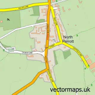
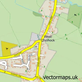
This Crewkerne street map is a detailed vector street map covering a 750m x 750m area. Select a larger area to create and download your own vector street map of Crewkerne.
The 750-metre map sample for Crewkerne covers 339 mapped buildings and approximately 18.0 km of road detail, of which 39 named roads are named. The immediate area includes 1 school, 1 GP surgery within 2 miles, 3 pubs and 2 MOT stations, with 6 within 2 miles. The wider area around Crewkerne features 5 tourism points of interest, 14 food and drink venues and 1 campsite within 2 miles. To create a larger or custom map of Crewkerne, the map builder lets you define your own coverage area and download editable SVG, PDF and PNG files.
Create a larger editable map of Crewkerne
Choose any area you need and generate a high-quality vector map instantly. Perfect for print, planning, design, business and personal use.

This Crewkerne street map in Somerset is available as downloadable SVG, PDF and PNG map files, or as a printed map for planning, business, display, education, local information and design work. You can also create a larger custom map area using the map selector.
What this Crewkerne map sample shows
Crewkerne lies within Crewkerne Cp parish, part of Crewkerne ward in the Somerset local authority area. The postcode geography for this area includes the TA postcode area, the TA18 postcode district and the TA18 7 postcode sector. Residents fall under the Nhs Somerset Integrated Care Board for NHS services.
Local features near Crewkerne
Within 2 milesAmenities and services in and around Crewkerne.
Administrative and postcode information for Crewkerne
Crewkerne lies within Crewkerne Cp parish, part of Crewkerne ward in the Somerset local authority area. The postcode geography for this area includes the TA postcode area, the TA18 postcode district and the TA18 7 postcode sector. Residents fall under the Nhs Somerset Integrated Care Board for NHS services.
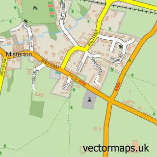
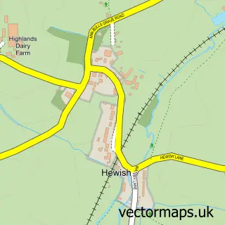
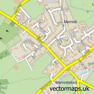
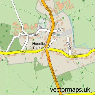
Nearby street map samples around Crewkerne

More street maps in Somerset
750 metre map area coverage
Boundary, postcode and point of interest information for the 750m x 750m rectangle centred on this sample map.
Boundaries containing map centre
Constituency: Yeovil Co Const
District: Somerset
Icb: NHS Somerset ICB
Parish: Crewkerne CP
Police Force: avon and somerset
Postcode District: TA18
Postcode Sector: TA18 7
Nearby boundaries intersecting sample
Postcode Sector: TA18 8
Postcode coverage
POI category counts
Antique Store: 10
Real Estate Agent: 9
Cafe: 7
Banks: 6
Charity Organization: 6
Flowers And Gifts Shop: 6
Barber: 5
Hair Salon: 5
Professional Services: 5
Beauty Salon: 4
Sample points of interest
- Chalmers & Co
- Chalmers & Co. SW Ltd.
- Rachel Moon Acupuncture
- Rachel Moon Acupuncture & Tuina Massage
- Neural Edge
- Crewkerne Cricket Club 2025
- Crewkerne RFC
- Crewkerne Rangers FC
- RSPCA
- Churchill’s Antiques & Collectables
- Crewkerne Antiques Centre
- Crooked Horn Antiques
Create a larger editable map of Crewkerne
This sample shows only a 750 metre area. To create a larger map of Crewkerne, use our map builder to choose your own coverage area, add titles and download editable SVG, PDF and PNG files.
Create a custom map of Crewkerne