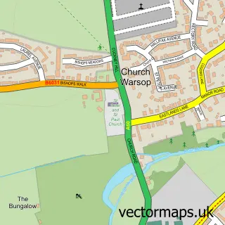
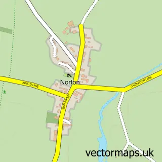
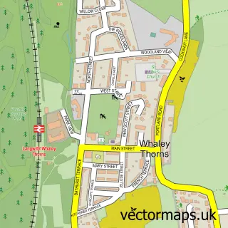
This Market Warsop street map is a detailed vector street map covering a 750m x 750m area. Select a larger area to create and download your own vector street map of Market Warsop.
The 750-metre map sample for Market Warsop covers 627 mapped buildings and approximately 30.6 km of road detail, of which 49 named roads are named. The immediate area includes 2 schools, 1 GP surgery, 6 pubs and 1 MOT station, with 4 within 2 miles. The wider area around Market Warsop features 1 tourism point of interest and 11 food and drink venues. To create a larger or custom map of Market Warsop, the map builder lets you define your own coverage area and download editable SVG, PDF and PNG files.
Create a larger editable map of Market Warsop
Choose any area you need and generate a high-quality vector map instantly. Perfect for print, planning, design, business and personal use.

This Market Warsop street map in Nottinghamshire is available as downloadable SVG, PDF and PNG map files, or as a printed map for planning, business, display, education, local information and design work. You can also create a larger custom map area using the map selector.
What this Market Warsop map sample shows
Market Warsop lies within Warsop Cp parish, part of Meden ward in the Mansfield District local authority area. The postcode geography for this area includes the NG postcode area, the NG20 postcode district and the NG20 0 postcode sector. Residents fall under the Nhs Nottingham And Nottinghamshire Integrated Care Board for NHS services.
Local features near Market Warsop
Within 2 milesAmenities and services in and around Market Warsop.
Administrative and postcode information for Market Warsop
Market Warsop lies within Warsop Cp parish, part of Meden ward in the Mansfield District local authority area. The postcode geography for this area includes the NG postcode area, the NG20 postcode district and the NG20 0 postcode sector. Residents fall under the Nhs Nottingham And Nottinghamshire Integrated Care Board for NHS services.
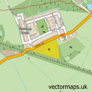
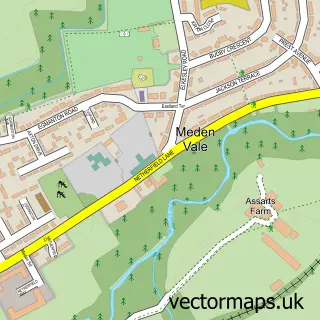
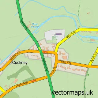
Nearby street map samples around Market Warsop

More street maps in Nottinghamshire
750 metre map area coverage
Boundary, postcode and point of interest information for the 750m x 750m rectangle centred on this sample map.
Boundaries containing map centre
Constituency: Mansfield Co Const
County: Nottinghamshire County
District: Mansfield District
Icb: NHS Nottingham and Nottinghamshire ICB
Parish: Warsop CP
Police Force: nottinghamshire
Postcode District: NG20
Postcode Sector: NG20 0
Ward: Meden Ward
Nearby boundaries intersecting sample
Ward: Market Warsop Ward, Warsop Carrs Ward
Postcode coverage
POI category counts
Beauty Salon: 8
Convenience Store: 7
Hair Salon: 7
Pub: 6
Gas Station: 4
Package Locker: 4
Tattoo And Piercing: 4
Beauty And Spa: 3
Contractor: 3
Fish And Chips Restaurant: 3
Sample points of interest
- Birkland Accountancy Services Ltd
- Nicholas & Walters - Chartered Accountants
- Isabelle Amante Artist
- The Sycamore and Poplars Care Home
- B Sweet
- The Cooperative Food (BF) Warsop, Warsop
- M Owen Bodyworks
- Market Warsop hand car wash
- Linen & Lace
- Unipart Car Care Centre
- eTuning Mansfield
- Campbells
Create a larger editable map of Market Warsop
This sample shows only a 750 metre area. To create a larger map of Market Warsop, use our map builder to choose your own coverage area, add titles and download editable SVG, PDF and PNG files.
Create a custom map of Market Warsop