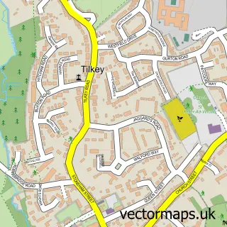
This Marks Tey street map is a detailed vector street map covering a 750m x 750m area. Select a larger area to create and download your own vector street map of Marks Tey.
The 750-metre map sample for Marks Tey covers 154 mapped buildings and approximately 10.7 km of road detail, of which 7 named roads are named. The immediate area includes 1 railway station, 1 GP surgery within 2 miles and 2 MOT stations, with 5 within 2 miles. The wider area around Marks Tey features 2 food and drink venues and 2 hotels. To create a larger or custom map of Marks Tey, the map builder lets you define your own coverage area and download editable SVG, PDF and PNG files.
Create a larger editable map of Marks Tey
Choose any area you need and generate a high-quality vector map instantly. Perfect for print, planning, design, business and personal use.

This Marks Tey street map in Essex is available as downloadable SVG, PDF and PNG map files, or as a printed map for planning, business, display, education, local information and design work. You can also create a larger custom map area using the map selector.
What this Marks Tey map sample shows
Marks Tey lies within Copford Cp parish, part of Marks Tey And Layer ward in the Colchester District (B) local authority area. The postcode geography for this area includes the CO postcode area, the CO6 postcode district and the CO6 1 postcode sector. Residents fall under the Nhs Suffolk And North East Essex Integrated Care Board for NHS services.
Local features near Marks Tey
Within 2 milesAmenities and services in and around Marks Tey.
Administrative and postcode information for Marks Tey
Marks Tey lies within Copford Cp parish, part of Marks Tey And Layer ward in the Colchester District (B) local authority area. The postcode geography for this area includes the CO postcode area, the CO6 postcode district and the CO6 1 postcode sector. Residents fall under the Nhs Suffolk And North East Essex Integrated Care Board for NHS services.
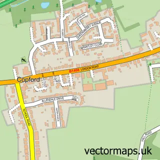
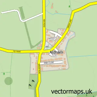
Nearby street map samples around Marks Tey


More street maps in Essex
750 metre map area coverage
Boundary, postcode and point of interest information for the 750m x 750m rectangle centred on this sample map.
Boundaries containing map centre
Constituency: Witham Co Const
County: Essex County
District: Colchester District (B)
Icb: NHS Essex ICB
Parish: Marks Tey CP
Police Force: essex
Postcode District: CO6
Postcode Sector: CO6 1
Ward: Marks Tey & Layer Ward
Nearby boundaries intersecting sample
Parish: Copford CP
Postcode coverage
POI category counts
Automotive Repair: 4
Building Supply Store: 3
Professional Services: 3
Bakery: 2
Butcher Shop: 2
Car Dealer: 2
Construction Services: 2
Contractor: 2
Convenience Store: 2
Gas Station: 2
Sample points of interest
- Penny Meadow
- Marks Tey Radio
- John Austin Vw-audi Specialists Ltd.
- Copford K.A vehicle sales
- Marks Tey Autospares
- Auto Spares
- John Austin VW-AudI Specialists Ltd
- John Austin Volkswagen & Audi Specialists
- S H Caravans
- Janes Pantry
- London Road Bakery, Marks Tey
- Glam Beauty Treatments
Create a larger editable map of Marks Tey
This sample shows only a 750 metre area. To create a larger map of Marks Tey, use our map builder to choose your own coverage area, add titles and download editable SVG, PDF and PNG files.
Create a custom map of Marks Tey