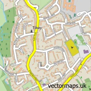
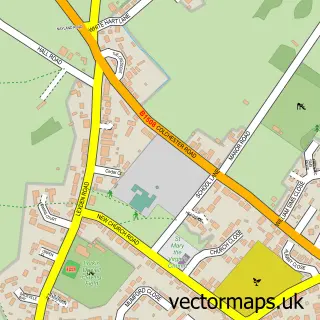
This Eight Ash Green street map is a detailed vector street map covering a 750m x 750m area. Select a larger area to create and download your own vector street map of Eight Ash Green.
The 750-metre map sample for Eight Ash Green covers 250 mapped buildings and approximately 8.2 km of road detail, of which 12 named roads are named. The immediate area includes 2 GP surgeries within 2 miles, 1 pub and 9 MOT stations within 2 miles. The wider area around Eight Ash Green features 1 food and drink venue and 1 campsite within 2 miles. To create a larger or custom map of Eight Ash Green, the map builder lets you define your own coverage area and download editable SVG, PDF and PNG files.
Create a larger editable map of Eight Ash Green
Choose any area you need and generate a high-quality vector map instantly. Perfect for print, planning, design, business and personal use.

This Eight Ash Green street map in Essex is available as downloadable SVG, PDF and PNG map files, or as a printed map for planning, business, display, education, local information and design work. You can also create a larger custom map area using the map selector.
What this Eight Ash Green map sample shows
Eight Ash Green lies within Eight Ash Green Cp parish, part of Lexden And Braiswick ward in the Colchester District (B) local authority area. The postcode geography for this area includes the CO postcode area, the CO6 postcode district and the CO6 3 postcode sector. Residents fall under the Nhs Suffolk And North East Essex Integrated Care Board for NHS services.
Local features near Eight Ash Green
Within 2 milesAmenities and services in and around Eight Ash Green.
Administrative and postcode information for Eight Ash Green
The local authority covering Eight Ash Green is Colchester District (B), within the county of Essex. The settlement lies within Lexden And Braiswick ward and Eight Ash Green Cp civil parish. The CO6 postcode district and CO6 3 postcode sector serve the immediate area. NHS provision in the area is delivered through East Suffolk And North Essex Nhs Foundation Trust.
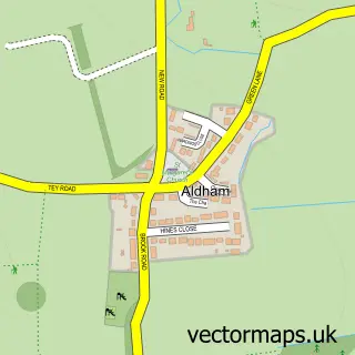
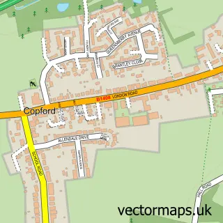
Nearby street map samples around Eight Ash Green


More street maps in Essex
750 metre map area coverage
Boundary, postcode and point of interest information for the 750m x 750m rectangle centred on this sample map.
Boundaries containing map centre
Constituency: Harwich and North Essex Co Const
County: Essex County
District: Colchester District (B)
Icb: NHS Essex ICB
Parish: Eight Ash Green CP
Police Force: essex
Postcode District: CO6
Postcode Sector: CO6 3
Ward: Lexden & Braiswick Ward
Nearby boundaries intersecting sample
Postcode District: CO3
Postcode Sector: CO3 9
Postcode coverage
POI category counts
Arts And Entertainment: 2
Dentist: 2
Anglican Church: 1
Automotive Repair: 1
Beauty And Spa: 1
Beauty Salon: 1
Community Center: 1
Cricket Ground: 1
Flowers And Gifts Shop: 1
Home Service: 1
Sample points of interest
- All Saints Church, Eight Ash Green
- Hugh Beattie Oil Portraits
- JHL Beattie
- AutoAid Accident Repair
- Threading & Beauty Parlour
- Permanent Make Up by Nicole
- Eight Ash Green Village Hall
- Eight Ash Green Cricket Club
- Eight Ash Green Dental Surgery
- Eight Ash Green Dental Surgery
- Aster la vista florist
- Rosedene Childcare
Create a larger editable map of Eight Ash Green
This sample shows only a 750 metre area. To create a larger map of Eight Ash Green, use our map builder to choose your own coverage area, add titles and download editable SVG, PDF and PNG files.
Create a custom map of Eight Ash Green