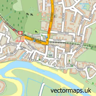
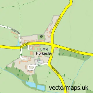
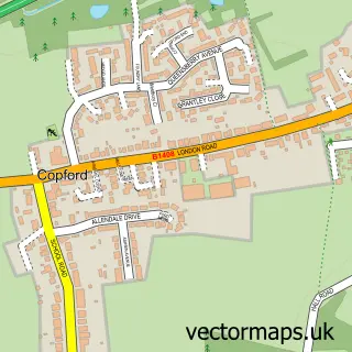
This West Bergholt street map is a detailed vector street map covering a 750m x 750m area. Select a larger area to create and download your own vector street map of West Bergholt.
The 750-metre map sample for West Bergholt covers 330 mapped buildings and approximately 11.3 km of road detail, of which 21 named roads are named. The immediate area includes 1 school, 3 pubs and 1 MOT station, with 6 within 2 miles. The wider area around West Bergholt features 3 food and drink venues and 1 campsite within 2 miles. To create a larger or custom map of West Bergholt, the map builder lets you define your own coverage area and download editable SVG, PDF and PNG files.
Create a larger editable map of West Bergholt
Choose any area you need and generate a high-quality vector map instantly. Perfect for print, planning, design, business and personal use.

This West Bergholt street map in Essex is available as downloadable SVG, PDF and PNG map files, or as a printed map for planning, business, display, education, local information and design work. You can also create a larger custom map area using the map selector.
What this West Bergholt map sample shows
West Bergholt lies within West Bergholt Cp parish, part of Lexden And Braiswick ward in the Colchester District (B) local authority area. The postcode geography for this area includes the CO postcode area, the CO6 postcode district and the CO6 3 postcode sector. Residents fall under the Nhs Suffolk And North East Essex Integrated Care Board for NHS services.
Local features near West Bergholt
Within 2 milesAmenities and services in and around West Bergholt.
Administrative and postcode information for West Bergholt
West Bergholt lies within West Bergholt Cp parish, part of Lexden And Braiswick ward in the Colchester District (B) local authority area. The postcode geography for this area includes the CO postcode area, the CO6 postcode district and the CO6 3 postcode sector. Residents fall under the Nhs Suffolk And North East Essex Integrated Care Board for NHS services.
Nearby street map samples around West Bergholt

More street maps in Essex
750 metre map area coverage
Boundary, postcode and point of interest information for the 750m x 750m rectangle centred on this sample map.
Boundaries containing map centre
Constituency: Harwich and North Essex Co Const
County: Essex County
District: Colchester District (B)
Icb: NHS Essex ICB
Parish: West Bergholt CP
Police Force: essex
Postcode District: CO6
Postcode Sector: CO6 3
Ward: Lexden & Braiswick Ward
Nearby boundaries intersecting sample
No additional intersecting boundaries found.
Postcode coverage
POI category counts
Pub: 3
Sports Club And League: 3
Flowers And Gifts Shop: 2
Used Car Dealer: 2
Accountant: 1
Anglican Church: 1
Architectural Designer: 1
Armed Forces Branch: 1
Arts And Crafts: 1
Arts And Entertainment: 1
Sample points of interest
- AIMS Accountants for Business
- St. Mary the Virgin, West Bergholt
- McLean Architectural
- Your AFBC
- Blue Owl
- Orpen Hall
- East of England Co-op WEST BERGHOLT (CZC)
- Becton Detailing Supplies Ltd.
- Becton Detailing Ltd
- Smooth Tune Colchester
- White Hart Inn Colchester
- St Mary the Virgin's Church
Create a larger editable map of West Bergholt
This sample shows only a 750 metre area. To create a larger map of West Bergholt, use our map builder to choose your own coverage area, add titles and download editable SVG, PDF and PNG files.
Create a custom map of West Bergholt