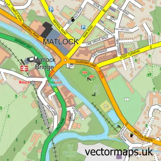
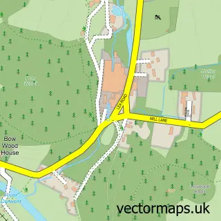
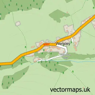
This Matlock Bath street map is a detailed vector street map covering a 750m x 750m area. Select a larger area to create and download your own vector street map of Matlock Bath.
The 750-metre map sample for Matlock Bath covers 190 mapped buildings and approximately 14.5 km of road detail, of which 14 named roads are named. The immediate area includes 1 railway station, 1 GP surgery within 2 miles, 7 pubs and 1 MOT station, with 10 within 2 miles. The wider area around Matlock Bath features 10 tourism points of interest, 17 food and drink venues and 6 hotels. To create a larger or custom map of Matlock Bath, the map builder lets you define your own coverage area and download editable SVG, PDF and PNG files.
Create a larger editable map of Matlock Bath
Choose any area you need and generate a high-quality vector map instantly. Perfect for print, planning, design, business and personal use.

This Matlock Bath street map in Derbyshire is available as downloadable SVG, PDF and PNG map files, or as a printed map for planning, business, display, education, local information and design work. You can also create a larger custom map area using the map selector.
What this Matlock Bath map sample shows
Matlock Bath lies within Matlock Bath Cp parish, part of Masson ward in the Derbyshire Dales District local authority area. The postcode geography for this area includes the DE postcode area, the DE4 postcode district and the DE4 3 postcode sector. Residents fall under the Nhs Derby And Derbyshire Integrated Care Board for NHS services.
Local features near Matlock Bath
Within 2 milesAmenities and services in and around Matlock Bath.
Administrative and postcode information for Matlock Bath
Matlock Bath lies within Matlock Bath Cp parish, part of Masson ward in the Derbyshire Dales District local authority area. The postcode geography for this area includes the DE postcode area, the DE4 postcode district and the DE4 3 postcode sector. Residents fall under the Nhs Derby And Derbyshire Integrated Care Board for NHS services.
Nearby street map samples around Matlock Bath

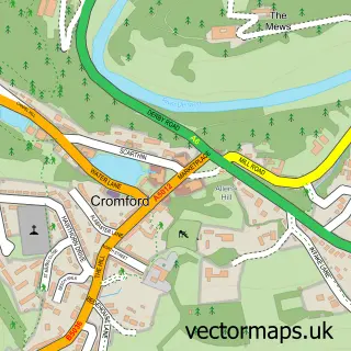
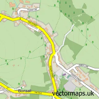
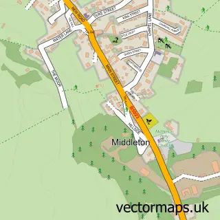
More street maps in Derbyshire
750 metre map area coverage
Boundary, postcode and point of interest information for the 750m x 750m rectangle centred on this sample map.
Boundaries containing map centre
Constituency: Derbyshire Dales Co Const
County: Derbyshire County
District: Derbyshire Dales District
Icb: NHS Derby and Derbyshire ICB
Parish: Matlock Bath CP
Police Force: derbyshire
Postcode District: DE4
Postcode Sector: DE4 3
Ward: Cromford & Matlock Bath Ward
Nearby boundaries intersecting sample
Parish: Cromford CP, Matlock Town CP
Postcode Sector: DE4 5
Ward: Matlock East & Tansley Ward
Postcode coverage
POI category counts
Fish And Chips Restaurant: 7
Pub: 7
Hotel: 6
Cafe: 5
Clothing Store: 5
Flowers And Gifts Shop: 5
Bed And Breakfast: 4
Ice Cream Shop: 4
Landmark And Historical Building: 4
Coffee Shop: 3
Sample points of interest
- Hope Terrace
- Moola Rewards Discount App
- Derwent Amusements
- Gulliver's Kingdom
- Antique Centre
- Aquarium Amusements
- Matlock Bath Aquarium
- Matlock Bath Arcades
- The Pavilion
- Matlock Bath Indoor Market
- Ardean Garage
- The Grand Pavilion
Create a larger editable map of Matlock Bath
This sample shows only a 750 metre area. To create a larger map of Matlock Bath, use our map builder to choose your own coverage area, add titles and download editable SVG, PDF and PNG files.
Create a custom map of Matlock Bath