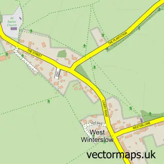
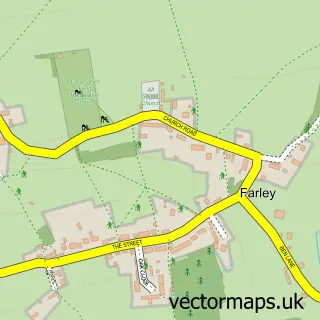
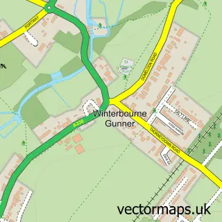
This Middle Winterslow street map is a detailed vector street map covering a 750m x 750m area. Select a larger area to create and download your own vector street map of Middle Winterslow.
The 750-metre map sample for Middle Winterslow covers 182 mapped buildings and approximately 11.0 km of road detail, of which 11 named roads are named. The immediate area includes 1 school, 2 pubs and 1 MOT station within 2 miles. The wider area around Middle Winterslow features 1 tourism point of interest, 2 food and drink venues and 1 campsite within 2 miles. To create a larger or custom map of Middle Winterslow, the map builder lets you define your own coverage area and download editable SVG, PDF and PNG files.
Create a larger editable map of Middle Winterslow
Choose any area you need and generate a high-quality vector map instantly. Perfect for print, planning, design, business and personal use.

This Middle Winterslow street map in Wiltshire is available as downloadable SVG, PDF and PNG map files, or as a printed map for planning, business, display, education, local information and design work. You can also create a larger custom map area using the map selector.
What this Middle Winterslow map sample shows
Middle Winterslow lies within Winterslow Cp parish, part of Winterslow ward in the Wiltshire local authority area. The postcode geography for this area includes the SP postcode area, the SP5 postcode district and the SP5 1 postcode sector. Residents fall under the Nhs Bath And North East Somerset, Swindon And Wiltshire Integrated Care Board for NHS services.
Local features near Middle Winterslow
Within 2 milesAmenities and services in and around Middle Winterslow.
Administrative and postcode information for Middle Winterslow
The local authority covering Middle Winterslow is Wiltshire, within the county of Wiltshire. The settlement lies within Winterslow ward and Winterslow Cp civil parish. The SP5 postcode district and SP5 1 postcode sector serve the immediate area. NHS provision in the area is delivered through Salisbury Nhs Foundation Trust.
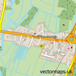
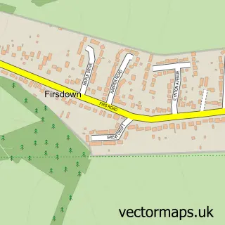
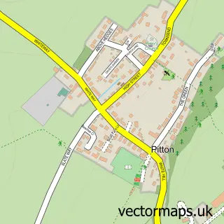
Nearby street map samples around Middle Winterslow

More street maps in Wiltshire
750 metre map area coverage
Boundary, postcode and point of interest information for the 750m x 750m rectangle centred on this sample map.
Boundaries containing map centre
Constituency: Salisbury Co Const
District: Wiltshire
Icb: NHS Bath and North East Somerset Swindon and Wiltshire ICB
Parish: Winterslow CP
Police Force: wiltshire
Postcode District: SP5
Postcode Sector: SP5 1
Nearby boundaries intersecting sample
No additional intersecting boundaries found.
Postcode coverage
POI category counts
Convenience Store: 2
Pub: 2
Alternative Medicine: 1
Bakery: 1
Elementary School: 1
Horse Equipment Shop: 1
Landmark And Historical Building: 1
Post Office: 1
Shoe Store: 1
Topic Concert Venue: 1
Sample points of interest
- Adding Zest
- Pump House Bakes
- Costcutter
- One Stop
- Winterslow C Of E Primary School
- West Country Equestrian
- Middle Winterslow
- Winterslow Post Office
- Lord Nelson Winterslow
- The Lord Nelson Arms
- CeCe and Me
- Winterslow Village Hall
Create a larger editable map of Middle Winterslow
This sample shows only a 750 metre area. To create a larger map of Middle Winterslow, use our map builder to choose your own coverage area, add titles and download editable SVG, PDF and PNG files.
Create a custom map of Middle Winterslow