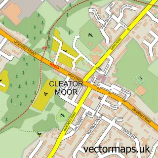
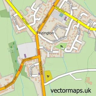
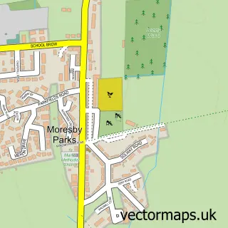
This Moor Row street map is a detailed vector street map covering a 750m x 750m area. Select a larger area to create and download your own vector street map of Moor Row.
The 750-metre map sample for Moor Row covers 168 mapped buildings and approximately 9.3 km of road detail, of which 13 named roads are named. The immediate area includes 1 school and 1 MOT station, with 4 within 2 miles. The wider area around Moor Row features 2 tourism points of interest. To create a larger or custom map of Moor Row, the map builder lets you define your own coverage area and download editable SVG, PDF and PNG files.
Create a larger editable map of Moor Row
Choose any area you need and generate a high-quality vector map instantly. Perfect for print, planning, design, business and personal use.

This Moor Row street map in Cumbria is available as downloadable SVG, PDF and PNG map files, or as a printed map for planning, business, display, education, local information and design work. You can also create a larger custom map area using the map selector.
What this Moor Row map sample shows
Moor Row lies within Egremont Cp parish, part of Moor Row & Bigrigg ward in the Cumberland local authority area. The postcode geography for this area includes the CA postcode area, the CA24 postcode district and the CA24 3 postcode sector. Residents fall under the Nhs North East And North Cumbria Integrated Care Board for NHS services.
Local features near Moor Row
Within 2 milesAmenities and services in and around Moor Row.
Administrative and postcode information for Moor Row
Moor Row lies within Egremont Cp parish, part of Moor Row & Bigrigg ward in the Cumberland local authority area. The postcode geography for this area includes the CA postcode area, the CA24 postcode district and the CA24 3 postcode sector. Residents fall under the Nhs North East And North Cumbria Integrated Care Board for NHS services.
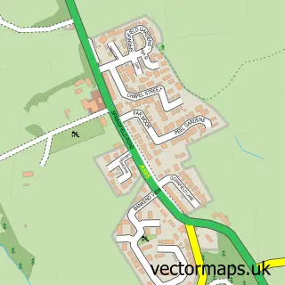
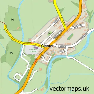
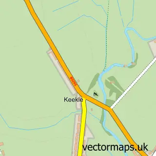
Nearby street map samples around Moor Row

More street maps in Cumbria
750 metre map area coverage
Boundary, postcode and point of interest information for the 750m x 750m rectangle centred on this sample map.
Boundaries containing map centre
Constituency: Whitehaven and Workington Co Const
District: Cumberland
Icb: NHS North East and North Cumbria ICB
Parish: Egremont CP
Police Force: cumbria
Postcode District: CA24
Postcode Sector: CA24 3
Ward: Egremont North and St. Bees Ward
Nearby boundaries intersecting sample
Parish: Cleator Moor CP
Postcode District: CA25
Postcode Sector: CA25 5
Ward: Cleator Moor West Ward
Postcode coverage
POI category counts
Park: 2
Professional Services: 2
Beauty Salon: 1
Bed And Breakfast: 1
Cleaning Services: 1
Elementary School: 1
Private Association: 1
Religious Organization: 1
Sample points of interest
- Lulabelless Beauty Room
- Jasmine House Bed and Breakfast
- Clean As a Whistle
- Moor Row Community Primary School
- Hard Knott Pass, Lake District
- Moor Row play park
- Moor Row Working Mens Club
- I Love You Thirteen
- Moor Row Working Mens Club
- Emmanuel Church
Create a larger editable map of Moor Row
This sample shows only a 750 metre area. To create a larger map of Moor Row, use our map builder to choose your own coverage area, add titles and download editable SVG, PDF and PNG files.
Create a custom map of Moor Row