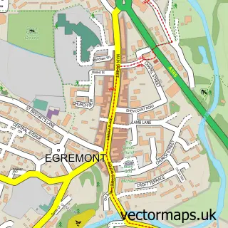
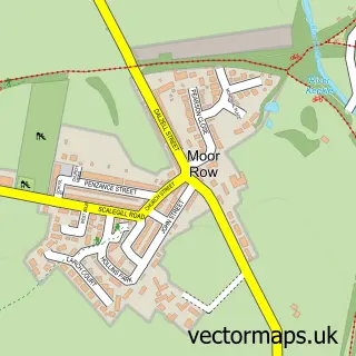
This St Bees street map is a detailed vector street map covering a 750m x 750m area. Select a larger area to create and download your own vector street map of St Bees.
The 750-metre map sample for St Bees covers 208 mapped buildings and approximately 11.8 km of road detail, of which 12 named roads are named. The immediate area includes 1 school, 1 railway station and 1 pub. The wider area around St Bees features 2 tourism points of interest, 2 food and drink venues and 2 hotels. To create a larger or custom map of St Bees, the map builder lets you define your own coverage area and download editable SVG, PDF and PNG files.
Create a larger editable map of St Bees
Choose any area you need and generate a high-quality vector map instantly. Perfect for print, planning, design, business and personal use.

This St Bees street map in Cumbria is available as downloadable SVG, PDF and PNG map files, or as a printed map for planning, business, display, education, local information and design work. You can also create a larger custom map area using the map selector.
What this St Bees map sample shows
St Bees lies within St. Bees Cp parish, part of St Bees ward in the Cumberland local authority area. The postcode geography for this area includes the CA postcode area, the CA27 postcode district and the CA27 0 postcode sector. Residents fall under the Nhs North East And North Cumbria Integrated Care Board for NHS services.
Local features near St Bees
Within 2 milesAmenities and services in and around St Bees.
Administrative and postcode information for St Bees
The local authority covering St Bees is Cumberland, within the county of Cumbria. The settlement lies within St Bees ward and St. Bees Cp civil parish. The CA27 postcode district and CA27 0 postcode sector serve the immediate area. NHS provision in the area is delivered through North Cumbria Integrated Care Nhs Foundation Trust.
Nearby street map samples around St Bees


More street maps in Cumbria
750 metre map area coverage
Boundary, postcode and point of interest information for the 750m x 750m rectangle centred on this sample map.
Boundaries containing map centre
Constituency: Whitehaven and Workington Co Const
District: Cumberland
Icb: NHS North East and North Cumbria ICB
Parish: St. Bees CP
Police Force: cumbria
Postcode District: CA27
Postcode Sector: CA27 0
Ward: Egremont North and St. Bees Ward
Nearby boundaries intersecting sample
No additional intersecting boundaries found.
Postcode coverage
POI category counts
Convenience Store: 2
Elementary School: 2
Hotel: 2
Preschool: 2
Alternative Medicine: 1
Anglican Church: 1
Bar: 1
Bed And Breakfast: 1
Books Mags Music And Video: 1
Charity Organization: 1
Sample points of interest
- Carolyn Nixon BSc, M.I.C.H.T
- Priory Church of St Mary & St Bega
- Albert Hotel
- Stonehouse Farm
- Post Office-St. Bees
- St Bees Library
- St Bees Priory Church
- Premier
- Premier St Bees Post Office
- Post Office Travel Money
- St Bees Village School
- The St Beghian Society - OSB
Create a larger editable map of St Bees
This sample shows only a 750 metre area. To create a larger map of St Bees, use our map builder to choose your own coverage area, add titles and download editable SVG, PDF and PNG files.
Create a custom map of St Bees