Vector Maps logo
Home Why it works Popular maps Districts Samples Customizer Create Your Map
VectorMaps.uk
Home Popular maps Districts Samples Customizer Create Your Map Privacy Disclaimer
Home / UK Maps / Aberdeenshire / New Byth Map

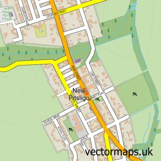
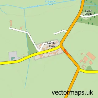
This New Byth street map is a detailed vector street map covering a 750m x 750m area. Select a larger area to create and download your own vector street map of New Byth.

New Byth is a village in Aberdeenshire, in the North East Scotland of Scotland. The settlement falls within the Banff And Buchan parliamentary constituency. It is served by the AB53 postcode district, with AB53 5 as the local postcode sector.

The 750-metre map sample for New Byth covers 153 mapped buildings and approximately 6.9 km of road detail, of which 9 named roads are named. To create a larger or custom map of New Byth, the map builder lets you define your own coverage area and download editable SVG, PDF and PNG files.

153Buildings
6.88 kmRoads
9Named roads
0Residents within 2 miles
Create your own

Create a larger editable map of New Byth

Choose any area you need and generate a high-quality vector map instantly. Perfect for print, planning, design, business and personal use.

Choose any location
Editable SVG files
Any size up to A0
PDF, PNG & more
Instant download
High quality guaranteed
Create My Custom Map
Secure, private & no credit card required
New Byth Vector Street Map
750m Sample
New Byth vector street map sample showing roads, buildings and local features in a 750 metre preview area
Buy New Byth Map Print from £12.95 Buy New Byth Digital Map from £6

This New Byth street map in Aberdeenshire is available as downloadable SVG, PDF and PNG map files, or as a printed map for planning, business, display, education, local information and design work. You can also create a larger custom map area using the map selector.

What this New Byth map sample shows

New Byth lies within Aberdeenshire parish, part of Troup ward in the Aberdeenshire local authority area. The postcode geography for this area includes the AB postcode area, the AB53 postcode district and the AB53 5 postcode sector. Residents fall under the Grampian for NHS services.

Administrative and postcode information for New Byth

New Byth lies within Aberdeenshire parish, part of Troup ward in the Aberdeenshire local authority area. The postcode geography for this area includes the AB postcode area, the AB53 postcode district and the AB53 5 postcode sector. Residents fall under the Grampian for NHS services.

Parish ABERDEENSHIRE
Ward Troup
District / local authority Aberdeenshire
County Aberdeenshire
Historic county Aberdeenshire
Postcode district AB53
Postcode sector AB53 5
Parliamentary constituency Banff and Buchan
Region North East Scotland
Country Scotland

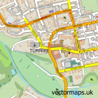
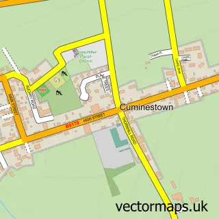
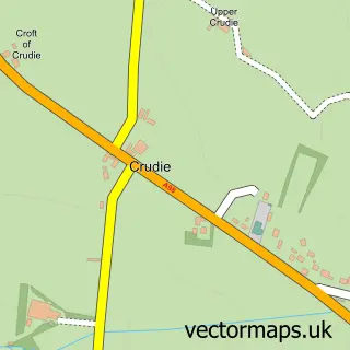
Nearby street map samples around New Byth

Street map sample of Turriff, Aberdeenshire Turriff Town - Aberdeenshire - 6.7 miles Street map sample of Aberdeen, City of Aberdeen Aberdeen City - City of Aberdeen - 30.5 miles Street map sample of Cuminestown, Aberdeenshire Cuminestown Village - Aberdeenshire - 2.6 miles Street map sample of Crudie, Aberdeenshire Crudie Village - Aberdeenshire - 2.7 miles Street map sample of New Pitsligo, Aberdeenshire New Pitsligo Village - Aberdeenshire - 3.9 miles Street map sample of Fintry, Aberdeenshire Fintry Village - Aberdeenshire - 4.3 miles Street map sample of New Deer, Aberdeenshire New Deer Village - Aberdeenshire - 5.9 miles Street map sample of Boyndlie, Aberdeenshire Boyndlie Village - Aberdeenshire - 6.6 miles Street map sample of Gardenstown, Banffshire Gardenstown Village - Banffshire - 6.8 miles Street map sample of New Aberdour, Aberdeenshire New Aberdour Village - Aberdeenshire - 6.9 miles

More street maps in Aberdeenshire

Street map sample of Cuminestown, Aberdeenshire Cuminestown Village - 2.6 miles Street map sample of Crudie, Aberdeenshire Crudie Village - 2.7 miles Street map sample of New Pitsligo, Aberdeenshire New Pitsligo Village - 3.9 miles Street map sample of Fintry, Aberdeenshire Fintry Village - 4.3 miles Street map sample of New Deer, Aberdeenshire New Deer Village - 5.9 miles

750 metre map area coverage

Boundary, postcode and point of interest information for the 750m x 750m rectangle centred on this sample map.

Boundaries containing map centre

Constituency: Aberdeenshire North and Moray East Co Const

District: Aberdeenshire

Icb: Grampian

Postcode District: AB53

Postcode Sector: AB53 5

Ward: Troup Ward

Nearby boundaries intersecting sample

No additional intersecting boundaries found.

Postcode coverage

AB53 AB53 5

POI category counts

Beauty Salon: 1

Day Care Preschool: 1

Food Beverage Service Distribution: 1

It Service And Computer Repair: 1

Pet Groomer: 1

Sample points of interest

  • Luxe Lashes By Shania Beauty Salon
  • Crudie Playgroup Day Care Preschool
  • Gilly's Take Away - Turriff Food Beverage Service Distribution
  • GST Computer Workshop It Service And Computer Repair
  • Canine Country Groom Pet Groomer

Create a larger editable map of New Byth

This sample shows only a 750 metre area. To create a larger map of New Byth, use our map builder to choose your own coverage area, add titles and download editable SVG, PDF and PNG files.

Create a custom map of New Byth

Phone 01751 473136 | Copyright Vectormaps.uk 2026

Samples Customizer Privacy Disclaimer
New Byth Vector Street Map
New Byth enlarged street map sample showing a 750 metre preview area