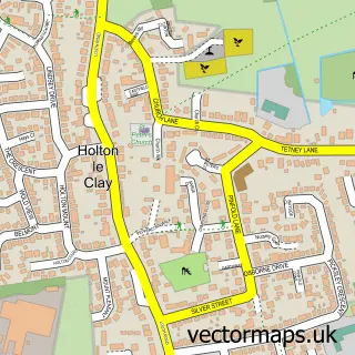
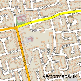
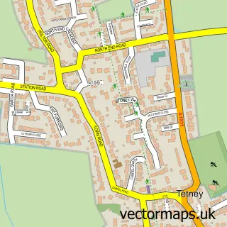
This New Waltham street map is a detailed vector street map covering a 750m x 750m area. Select a larger area to create and download your own vector street map of New Waltham.
The 750-metre map sample for New Waltham covers 727 mapped buildings and approximately 16.7 km of road detail, of which 49 named roads are named. The immediate area includes 1 school, 2 GP surgeries within 2 miles, 1 pub and 8 MOT stations within 2 miles. The wider area around New Waltham features 4 food and drink venues. To create a larger or custom map of New Waltham, the map builder lets you define your own coverage area and download editable SVG, PDF and PNG files.
Create a larger editable map of New Waltham
Choose any area you need and generate a high-quality vector map instantly. Perfect for print, planning, design, business and personal use.

This New Waltham street map in Lincolnshire is available as downloadable SVG, PDF and PNG map files, or as a printed map for planning, business, display, education, local information and design work. You can also create a larger custom map area using the map selector.
What this New Waltham map sample shows
New Waltham lies within Humberston Cp parish, part of Humberston And New Waltham ward in the North East Lincolnshire (B) local authority area. The postcode geography for this area includes the DN postcode area, the DN36 postcode district and the DN36 4 postcode sector. Residents fall under the Nhs Humber And North Yorkshire Integrated Care Board for NHS services.
Local features near New Waltham
Within 2 milesAmenities and services in and around New Waltham.
Administrative and postcode information for New Waltham
The local authority covering New Waltham is North East Lincolnshire (B), within the county of Lincolnshire. The settlement lies within Humberston And New Waltham ward and Humberston Cp civil parish. The DN36 postcode district and DN36 4 postcode sector serve the immediate area. NHS provision in the area is delivered through Northern Lincolnshire And Goole Nhs Foundation Trust.
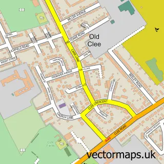
Nearby street map samples around New Waltham

More street maps in Lincolnshire
750 metre map area coverage
Boundary, postcode and point of interest information for the 750m x 750m rectangle centred on this sample map.
Boundaries containing map centre
Constituency: Brigg and Immingham Co Const
District: North East Lincolnshire (B)
Icb: NHS Humber and North Yorkshire ICB
Parish: New Waltham CP
Police Force: humberside
Postcode District: DN36
Postcode Sector: DN36 4
Ward: Humberston and New Waltham Ward
Nearby boundaries intersecting sample
Parish: Humberston CP
Postcode coverage
POI category counts
Convenience Store: 7
Beauty Salon: 5
Building Supply Store: 4
Professional Services: 4
Post Office: 3
Bakery: 2
Child Care And Day Care: 2
Contractor: 2
Elementary School: 2
Package Locker: 2
Sample points of interest
- D & BJ Services Ltd.
- Bmx Race Track New Waltham
- St Matthew's, New Waltham
- Sparkeys Property Ltd
- Grimsby Motorhomes
- Gilmore Holdings Ltd
- Mrs Browns Bakes
- Traceys Lovely Cakes
- Chesters Barber Shop
- Angela's Cutting Crew
- Beauty By Char
- Elegant Aesthetics by Becky
Create a larger editable map of New Waltham
This sample shows only a 750 metre area. To create a larger map of New Waltham, use our map builder to choose your own coverage area, add titles and download editable SVG, PDF and PNG files.
Create a custom map of New Waltham